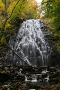
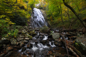
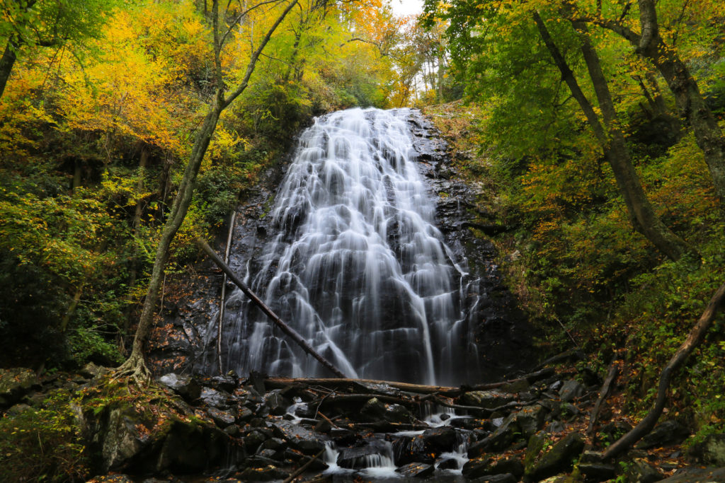
 Crabtree Falls is located at milepost 339.5 on the Blue Ridge Parkway. The Crabtree Falls Loop Trail is 2.5 miles. This 70 foot waterfall never fails to impress.
Start the hike on the paved trail behind the parking area. Follow the short paved section and pass the old amphitheater. The path winds through a meadow filled with wildflowers. In about 0.2 miles there is a fork. Go right to stay on the path to the falls. There should be a sign marking the way. You’ll come out on the Crabtree Meadows Campground road after about 450 feet. Ahead of you and to the right (across the campground road) is a parking area. Go to the back of that parking area and you’ll see the trailhead and a trail sign.
 This trail sign lists the hike as a 2 mile strenuous loop, however it is 0.6 miles to the falls and 1.9 miles from the falls back to the campground, so it’s actually a 2.5 mile hike from this sign. When you add in the 0.5 mile hike from the visitor center, it brings the total to 3 miles.
Take the trail behind the sign. It is estimated that it will take 45 minutes to reach the waterfall from this point. You’ll quickly reach the intersection with the other side of the loop. Turn right to begin the descent to Crabtree Falls. The trail at the beginning takes you through the forest on a wide, smooth, and graveled path. Throughout the trail you’ll see all kinds of large trees, including oaks, maples, and hemlocks.
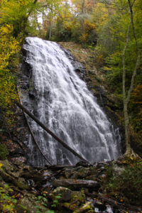 The trail begins going downhill through a shallow, mostly dry, stream at the bottom. When the stream becomes much steeper, the trail turns toward the right into the mountainside. Here, the trail surface becomes considerably rougher. This is where the trail becomes a moderate/strenuous trail. You can also begin to hear the waterfall as well. The trail has many switchbacks before you reach the base of the falls. There are several rocky sections, tree roots, wet areas, and sets of rock steps. At the base of the waterfall, the trail crosses a wooden bridge with a bench. The boulders and rocks around the base and sides of the waterfall are very slippery so if you leave the bridge and trail area, please use caution. At this point you can either turn around and go back the way you came or continue on the loop.
The loop continues just past the waterfall. This brings you to the hardest part of the hike. The trail becomes very steep and climbs about 200 feet within the next 0.25 miles. There are many switchbacks as it ascends the ridge. As you near the top there is a bench for you to rest on before you continue on to a long set of stairs. Keep following the ridge and then you will come to some stone walls on the sides of the trail. The trail becomes a little less steep from here on.
You’ll come to a rocky outcrop and the trail runs along the side of this rock cliff. You’ll come to some more steps, which brings you to the top of the really steep part of the trail. From here on the trail widens and is mostly smooth. There are a few stream crossings, but there are bridges giving you easy access. Continue on until you complete the loop. Walk back to the campground parking lot and cross it to return to where you parked your car.
Love visiting here and seeing all of nature’s beauty. Keep up the great posts!
Crabtree Falls is awesome! It’s a challenging hike for beginners, but it’s worth it in the end. I do hikes like this all the time, however my girlfriend said it was challenging as she is not used to hiking.