Having a lot of family members who cannot hike far and like to look at waterfalls, I’ve been searching for new waterfalls for them to visit. We haven’t explored a lot in the Virginia area, so I decided to see if I could find any that would fit the bill. I came across Logan Creek Falls, also known as the Falls of Logan Creek. Sometimes waterfalls are a little lower in water flow starting in May, but I figured we’d give it a shot. We were not disappointed.
Getting There
On our way we passed lots of signs saying switchbacks and don’t trust your GPS. I was expecting really tight switchbacks, like a lot of the areas close to home, but these weren’t bad. They weren’t too tight and the lanes are plenty wide. You do, however, have to watch out for crazy people that drive way over the speed limit and fly around the turns in the middle of the road, cutting into the other lane. Other then that I didn’t think the road was bad. I used Google Maps to get there, but had printed directions just in case. It got us pretty close to the parking area. It wanted us to go just a little past, but we saw a few cars in the parking area and decided to pull in and check. About a minute later a group was coming up the trail and confirmed that we were in the right place. There is no signage for the parking area or the trail.
Depending on how people park there cars and how big they are you can fit between 3-6 cars. If they parallel park there’s only room for about 3, but if people back in you could probably fit about 6.
Short, Easy Trail
If you’re looking for a short, easy trail with a big payoff, this one’s for you! From the parking area, the trail starts to your left. A lot of people call Logan Creek Falls a roadside waterfall, but in my opinion a roadside waterfall should be able to be seen from the roadside and this one isn’t. However, it’s only 0.2 miles in length round trip to reach the waterfall and the trail is located next to the road. It is an out-and-back trail on really flat, level ground. There are a few roots to navigate, but not many.
The trail runs between the road and the creek. The trail is narrow so passing other hikers can be challenging, but there are several areas where you can step off to the side to let others pass. It is easier to do this going toward the waterfall, rather than returning to the parking area. The trail is easy to follow, even for those, like myself, who are directionally challenged.

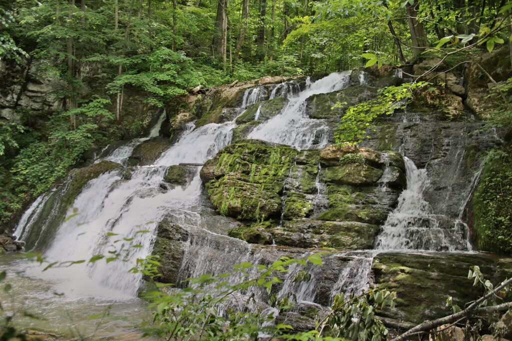
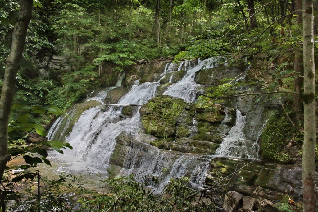
There are several places along the way where you can view the creek and the scenic views. The waterfall itself is very easy to see from the trail. You will need to walk down a side trail for a better view, but there’s a great view just a short distance down a side trail.
Reaching the Base
We continued down a side trail that would have taken us to the base of Logan Creek Falls, however there were multiple fallen trees directly in the way stacked on top of each other so we were unable to do so. However from our vantage point we were still able to see the full waterfall.
The side trails heading down to Logan Creek Falls were well packed and not rooty. The one we went down was a little bit steep, but not too bad. It would have been harder if the trail had been muddy, but still doable with hiking poles. Hiking poles are not necessary unless the trail is muddy and you want to venture closer to the waterfall.
Final Thoughts
This waterfall is family friendly and accessible for almost anyone. The best views of Logan Creek Falls are closer to the waterfall and can be reached by side trails heading down toward the waterfall.
While we weren’t able to get all the way to the bottom, we were able to get pretty close. Hopefully someone will clear the area soon so people can reach the base once again.
Also worth noting is that we had a snake cross the road in front of us right by the parking area.
There are no picnic tables or restroom facilities at this waterfall.
Other Nearby Attractions
Less than 30 miles away you can visit several other attractions. One of our favorites is Backbone Rock and Backbone Falls. There’s lots to explore in these areas and Backbone Falls is one of the most unique waterfalls I’ve seen. Eight miles away from Backbone Falls, you can see Mock’s Mill Falls, located at the Damascus Old Mill Inn hotel and restaurant. A few minutes away from Mock’s Mill Falls is one of the entrances to the Virginia Creeper Trail. This entrance has a display of trains and a great view of a creek running under a large bridge. Nine minutes away from Mock’s Mill Falls, you’ll reach Alvarado Road Falls. This waterfall is a small roadside waterfall, while not worth a special trip is worth a detour if it has rained recently.
Leave a Reply