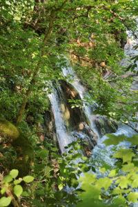
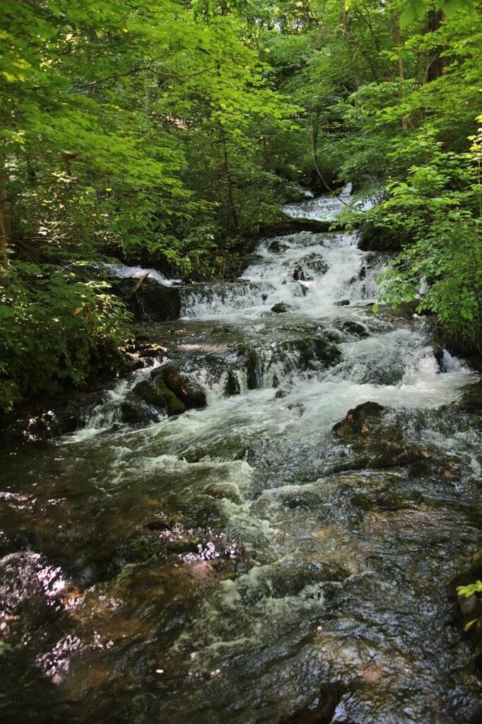
Mill Springs Mill Falls is located just below Mill Springs Mill. It has two distinctive, beautiful 30-foot drops into Lake Cumberland that emerge from springs above to create double cascades.
There are 13 springs that feed the mill, many of which are quite pretty. Most of the area around the mill is paved, but uneven, and winds around the mill and cascades.
In the Spring you’ll need to view Mill Springs Mill Falls from kayak or boat since you can’t get down into the water from a side trail by the restrooms. However part of it can be viewed from above through the trees. When the water is lower you can wade out into the water and see all of Mill Springs Mill Falls. If you decide to visit by boat, the mill has a boat dock.
The cascades are more impressive during the Spring or after a good rain. While I wasn’t able to view all of Mill Spring Mill Falls due to all of the recent rain, one of the cascades was running really well and was quite pretty.
About the Mill
You can stroll all round the mill on paved walkways. I went just before opening weekend of the season and had the place all to myself with the exception of the caretaker of the mill. He did mention that copperheads are common there and will strike without provocation so to keep an eye out for them. Luckily I had no encounters.
It was quite peaceful just walking around the quiet grounds and taking in all that nature has to offer. Once opening weekend kicks in the place has other things to offer including the fully operational mill itself, with a 40-foot overshot water wheel, the largest of its kind in the world.
Sitting on the shores of Lake Cumberland, first mill at Mill Springs was built in 1817. However, in 1824 the mill burned down due to a fire. The rebuilding and reconstruction was of the mill was completed in 1839.
On Jan. 19, 1862, the Battle of Mill Springs was fought. It was one of the first great battles of the Civil War.
In 1877, Lloyd Lanier and Arthur Rankin, purchased the mill and built present day 34 x 40 foot, three story mill. In 1908, the 28-foot cedar wheel was replaced by a steel water wheel. Thomas Roberts operated the mill under the name of the “Diamond Roller Mill” until 1949 when the federal government acquired the mill and lands as part of the Lake Cumberland project. That mill was later sold and the current mill, operated by the Army Corps of Engineers, was constructed.
In 1963 the Monticello Woman’s Club and other civic organizations, with assistance from the Kentucky Department of Highways, reactivated the mill.
In 1973 the mill was designated as a National Historic Site.
In 1976, a major restoration to the structure and grounds was completed by the U.S. Army Corps of Engineers. Traditional tools and skills were used to render the Mill as close to the original work as possible.
The mill is open from 9 am to 5 pm daily. This is an operating grist mill where you can watch the process of grinding the corn and making cornmeal. Then you can go up to the gift shop, operated by the Monticello Women’s Club, and purchase the cornmeal and take it home. The gift shop is open Sunday from 1 to 5 p.m.; Friday, Saturday and Monday from 10 a.m. to 5 p.m.; and Tuesday and Thursday from 11 a.m. to 4 p.m.
Corn is ground Saturdays, Sundays, and on the holidays at 2 pm. Using two 48-inch stones, or French burrs, imported from a quarry in northern France, the mill produces 800 pounds (up to 1,600 pounds of corn if both are running) an hour. It is a massive water wheel and quite impressive when it starts turning. The mill also offers tours.
Warning if Using Google Maps
Google Maps gave me major issues finding the mill when I typed in Mill Springs Mill, however when I entered the Brown-Lanier House. It took me right to the parking lot of the Brown-Lanier House, which is right next to the parking lot for the Mill Springs Mill.
The mill has ample parking and restroom facilities.
Leave a Reply