Note: Article update September 24, 2025.
We have noticed that social media and the internet in general has a lot of inaccurate and conflicting material on closures due to Hurricane Helene.
Our data in this article comes from official sources. This article will be updated as repairs complete or reopenings occur. We have included links throughout the article, which is the fastest way to check and see if closures remain in place for the duration specified by the agencies as time progresses.
If you see something posted on an official site that we have missed or has changed after article publication, please notify us.
The Impact of Hurricane Helene
When you think about hurricanes, people typically think about coastal areas. However, with Hurricane Helene, most of the most severely damaged areas were not where Helene reached the coast, but much further inland. Hurricane Helene was the deadliest to strike the mainland United States since Hurricane Katrina in 2005. United States Transportation Secretary Sean Duffy said this would “be the most expensive emergency relief project that we have ever had in the country.”
Although Helene made landfall in Florida and affected Florida and Georgia, the most damage occurred in North Carolina, Tennessee and South Carolina.
Several of these areas had weeks of drought, followed by heavy rainfall for a week leading up to the arrival of Helene. Unlike a lot of states, in the majority of the areas typically affected by hurricanes, the soil is clay, not sand. Sand absorbs the water much faster than clay, and absorbs more water. Because of the previous rainfall the land was saturated when Helene hit, and had no where to go.
Because of the mountainous area, the water was not distributed, but ran downhill, and collected. This resulted in landslides, flooding, the destruction of many bridges, roads, and extensive damage because of downed trees and debris.
North Carolina
Immediately following Hurricane Helene, 13 of North Carolina’s State Parks were closed due to extensive damage and the need of the rangers to assist with the statewide emergency and rescue efforts through October 31, 2024.
Chimney Rock State Park has reopened most of its park. However, the Eagle Rock Access remains closed until further notice. The only parking area available to access Eagle Rock is Buffalo Creek Park, which remains closed. All hiking trails are open, however the biking trails are still closed. The Chimney Rock attraction is open 7 days a week. All guests must reserve their timed-entry visit in advance. The elevator is operational. The only open route into Chimney Rock is NC 9 through Lake Lure. All other routes are closed to non-local traffic, including US 74A from Asheville, US 64 from Hendersonville, and NC 9 from Black Mountain.
Mount Mitchell State Park has reopened. The Blue Ridge Parkway is open up to the state park entrance but remains closed from just past Mount Mitchell through milepost 334 near Little Switzerland. A few trails are still closed.
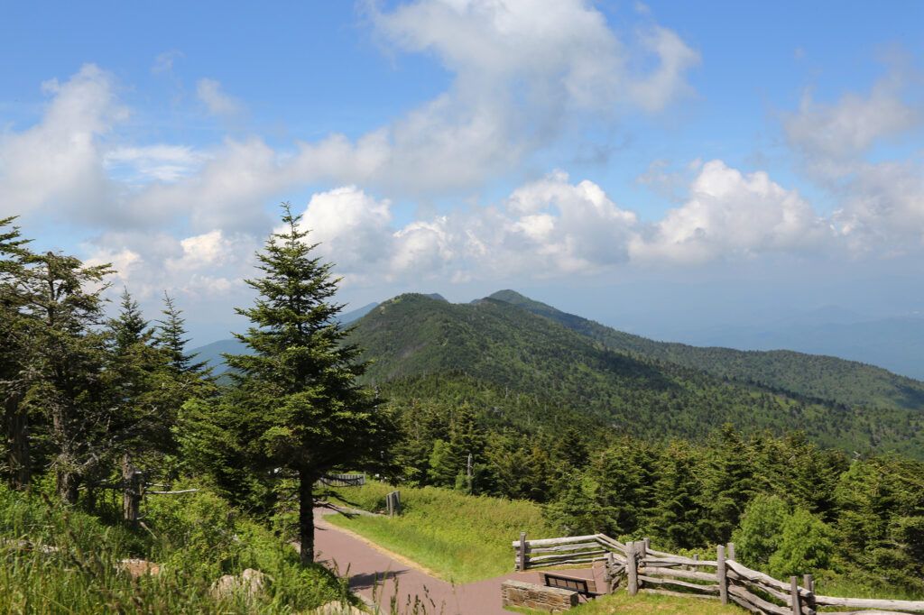
South Mountains State Park in Burke County has reopened both accesses after being closed since Hurricane Helene. Some facilities at South Mountains State Park remain closed until further notice. The entirety of High Shoals Falls Loop is closed. Waterfall viewing areas remain closed due to continued hazards.
The following are closed:
- The entirety of High Shoals Falls Loop, including waterfall viewing areas
- Headquarters, Shinny, and Possum Trails at Jacob Fork access
- No trail access for mountain biking or horseback riding. Clear Creek Trail at Clear Creek access in Morganton is open for equestrian use.
- Shinny Creek and Upper Falls backpack campsites
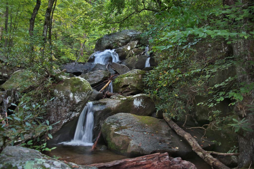
Several trails in the Grandfather Ranger District remain closed. Current closures:
McDowell County:
- Curtis Creek Campground
- Lower Heartbreak Ridge Trail (TR207)
- Curtis Creek Fishing Access (TR1110)
- Newberry Creek Trail (TR210)
- Snooks Nose Trail (TR211)
- Hickory Branch Trail (TR213)
- Sugar Cove Trail (TR219)
- Sections of the Meadows Loop Trail
- Section of the Mountains to Sea Trail where it crosses the North Fork River (bridge out)
Burke County:
- Sections of the Linville Gorge Trail (TR231)
- Greentown Shortcut Trail (TR268A)
Caldwell County:
- Wilson Creek Gorge Day Use Area (no activities permitted in area during closure)
- Harper Creek Trail (TR260)
- Wilson Creek Trail (TR258)
- Wilson Creek Spur Trail (TR258A)
The following roads remain closed to motorized vehicles, but are open to recreational foot, bike, and equestrian use:
McDowell County:
- Curtis Creek Road (FSRD482 – gated below campground)
- Jarrett Creek Road (FSRD4030 – gated before Gateway Trailhead – bridge out)
Burke County:
- New Gingercake Road (FSRD496)
- Table Rock Road (FSRD99 – paved section to Table Rock)
Caldwell/Avery Counties:
- Thunderhole Road (FSRD4071)
- Lost Cove Road (FSRD 464A)
The following roads in McDowell County are not passable, even for non-motorized traffic due to extreme damage. Use of these roads on foot, bike, or equestrian is not recommended:
- Newberry Creek Road (FSRD482A)
- Sugar Cove Road (FSRD1188)
- Good Cemetery Road (FSRD4008)
- Little Buck Road (FSRD470)
- Parris Creek Road (FSRD1186)
Several trails, recreation sites and roads in the Appalachian Ranger District remain closed until further notice. Closed locations are:
Mitchell County Trails & Roads
- Poplar Boat Launch Road
Buncombe County – Includes Big Ivy, Coleman Boundary, Shope Creek, Douglas Falls, Stony Fork
- TR 162 Douglas Falls
- TR 166 Elk Pen
- TR 165 Walker Creek
- TR 170 Snowball (after Hawkbill Rock to the old fire site is closed. Snowball to Hawkbill Rock is open.)
- TR 174 Little Andy
- TR 173 Upper Corner Rock
- TR 175 Perkins
- TR 176 Bear Pen
- TR 183 Staire Creek
- FSR 63 Stoney Fork
- FSR 63A Hawksbill Creek
- FSR 74 Big lvy (Coleman Boundary)
- FSR 231 Lower Staire
Yancey County -Includes South Toe, Mount Mitchell
- TR 182 Green Knob
- TR 186 Bald Knob Ridge
- TR 190 Mt. Mitchell- partially closed from Commissary Ridge to Black Mountain Campground/TH
- TR 190A Higgins Bald
- TR 191 Buncombe Horse- Closed from the Buncombe Horse Trailhead near Colbert’s Creek to Maple Camp Bald and closed from the junction of Mt. Mitchell State Park’s Commissary Trail to the intersection with the Mountains to Sea Trail to the South Toe Trailhead on FSR 472 (South Toe River Road)
- TR 192 Devil’s Den Nature
- TR 197 Setrock
- TR 200 South River Loop
- TR 200A North River Loop
- TR 201 S. Toe Fishing
- TR 1006 Briar Bottom Bike
- FSR 472 South Toe River
- FSR 472F Black Mtn
- FSR 5544 Briar Bottom
- FSR 2074 Neals Creek
- FSR 5511 Seven Mile Ridge
- FSR 5500A Hunt Camp
- Black Mountain Campground
- Briar Bottom Campground
- Ray Mine
Haywood County -Includes Harmon Den
- FSR 233 Haynes Road (Also Called Hurricane Creek)
- FSR 3573 Hurricane Spur
- FSR 288 Buzzard Roost Road- If the gates are closed, that portion of road is closed.
All trails in the Pisgah Ranger District are open. Many have storm damage including washed-out bridges, tripping hazards, landslides, eroded areas, muddy or slick areas, and downed trees. The following roads are closed:
- #475B – Headwaters (lower end) – (closed to motor vehicles, it is still passable for hiking/biking/foot/horse traffic)
- The lower end from Davidson River Rd to Sunwall Trailhead is closed, upper end is open.
- #477 – Avery Creek – Phase 1 repairs are estimated to be completed this week. The lower end from SR 276 to the Pisgah Riding Stables will reopen soon.
- #471 – Cathey’s Creek (The Upper end will reopen soon.)
- #140 – Courthouse Creek
- #229 – Pilot Mountain
- #1206 – Yellow Gap (Closed from Wolf Ford CG to North Mills River CG)
Planned construction:
- #471 – Cathey’s Creek – Emergency repairs above Cathey’s Creek Falls and near the City of Brevard Water Intake. Sporadic closures as needed.
- Construction on two bridges on Davidson River Road (#475) near Cove Creek will begin late summer/early fall.
- The new English Chapel Bridge work began on new abutments late June.
The Blue Ridge Parkway experienced severe damage as a result to Hurricane Helene. Large portions of the Blue Ridge Parkway remain closed until further notice. The Blue Ridge Parkway has a page dedicated to closures. Areas affected are:
milepost 63.5 – milepost 63.9 (VA section) – closed for bridge rehabilitation. Detour signs in place from MP 61.4 – MP 64.
milepost 95 to milepost 106 (VA section) – closed for repaving and rehabilitation.
milepost 120.3 (VA section) – Roanoke Mountain Loop closed until further notice
milepost 248.1 to milepost 249.3 – Multi-year road construction project which is currently underway and Laurel Fork Bridge replacement.
milepost 261.2 to milepost 276.4 – NC-16 to US 421 Multi-year road construction project which is currently underway.
milepost 276.4 – 280.9 – Construction rehabilitation project – signed detour
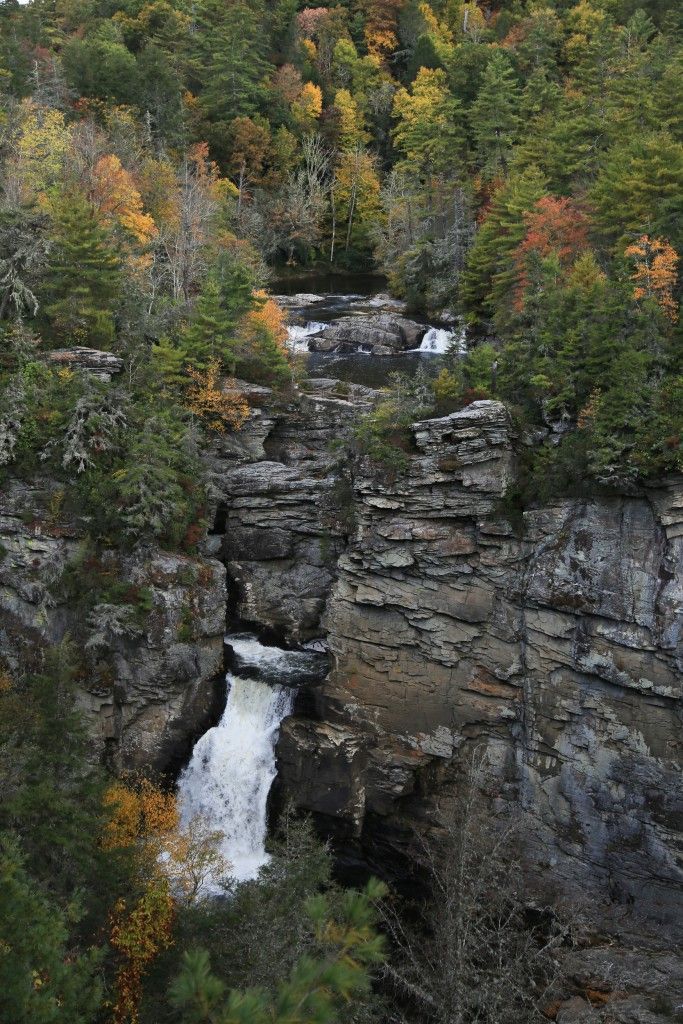
milepost 316.5 – Linville Falls Spur Road closed due to Hurricane Helene damage
317.5 to milepost 324.7 – US Highway 221 to Jacksontown Access Road (Bear Den Campground) are all closed due to Hurricane Helene damage.
milepost 324.7 – 327.5 – Partial closure due to Hurricane Helene damage. Parkway access to the Orchard at Altapass available from the south.
milepost 333.9 to milepost 355.3 – Little Switzerland to Victor Crossing, Victor Crossing to NC Highway 80, Mount Mitchell State Park are closed due to Hurricane Helene damage.
milepost 364.5 to milepost 367.6 – Craggy Gardens Picnic Area, Mountains-To-Sea Trail from Craggy Trail Shelter to the Snowball Mountain Trail closed due to Hurricane Helene damage. USFS Road 63 (Stoney Fork Access Rd) closed until further notice (USFS Gate).
Tennessee
David Crockett Birthplace State Park experienced catastrophic damage from flooding during Hurricane Helene, which washed away all the farmstead buildings, cabins, and playgrounds and left nearly a foot of mud on the trails. David Crockett Birthplace State Park is closed until further notice and is currently undergoing extensive repairs. While the park itself is closed the rangers are hosting a variety of events for visitors to attend. Please use this link to view upcoming events.
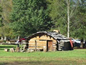
David Crockett Birthplace State Park before Hurricane Helene
These structures and many more were all washed away.
Roan Mountain State Park has reopened since Hurricane Helene, but still has areas of the park that will remain closed until further notice.
The following trails are inaccessible and will be closed indefinitely:
- Bearwallow Trail
- Chestnut Ridge Trail
- Forest Road Trail
- Turkey Trot Trail
Hampton Creek Cove State Natural Area, has reopened, however the Birchfield Trail was completely destroyed and is closed indefinitely due to storm damage.
The Great Smoky Mountains National Park, according to their website, still has several trails closed because of damage from Hurricane Helene, including:
Cataloochee Area trail closures due to Hurricane Helene damage:
- Balsam Mountain Trail – The trail has not been assessed from Gunter Fork to the Appalachian Trail. Gunter Fork Trail is closed.
- Big Fork Ridge Trail – Foot logs are out at Caldwell and Cataloochee Valley Road junction.
- Boogerman Trail – According to the park, hiking on this trail is not advised due to a deep water crossing. The first foot log on this trail, which was 55 feet in length, was washed away. This water crossing is typically more than two feet deep even when water levels are low.
- Caldwell Fork Trail – Trail closed to all users due to significant damage. Large sections of trail surface washed away; numerous rock slides and debris are obstructing the path; and multiple water crossings have become unsafe due to the loss of bridges.
- Hemphill Bald Trail – According to the park, hikers should use extra caution. From Double Gap to Caldwell junction there are two sections of trail impacted by landslides; one root ball has torn up the trail tread. Closed to equestrians.
- Palmer Creek Trail – The second foot log is gone.
- Pretty Hollow Gap Trail – According to the park, hikers should use extra caution. Trail/road is washed out from Little Cataloochee trail junction to campsite #39. Closed to equestrians.
- Rough Fork Trail – The first and third foot logs are out. There is extensive trail erosion from the first creek crossing to the junction with Woody house. Closed to equestrians.
Big Creek Area trail closures due to Hurricane Helene damage:
- Big Creek Trail – The trail is only open for first two miles to hikers and equestrians. Trail is closed after Mouse Creek Falls due to significant trail damage. There is no access to campsites #36 and #37 from the Big Creek Trail. Parking is only available near the ranger station. The walk to trailhead is approximately ¾ miles. Big Creek may be impassable during high water. According to the park, hikers should use extreme caution when crossing Big Creek and do so at their own risk.
- Gunter Fork Trail – The trail is completely closed to all users due to significant damage. Large sections of trail surface washed away; numerous rock slides and debris are obstructing the path; and multiple water crossings have become unsafe due to the loss of bridges.
- Swallow Fork Trail – The trail is completely closed to all users due to significant damage. Multiple foot logs are out including large bridges, crossing may be high risk during rain events.
Trails that are open, but still have significant damage:
- Bullhead Trail – Closed Mondays through Fridays May 5 through November 6 for trail rehabilitation. Trail is open Friday/Saturday/Sunday and federal holidays, but travel is not recommended due to trail tread damage.
Trails closed to equestrians: Lower Mount Cammerer Trail (open to hikers who should use caution due to tread damage), Hyatt Ridge Trail, Enloe Creek Trail, and Camel Gap Trail.
Backcountry campsite closures due to Hurricane Helene damage: #41 and #42. Backcountry campsites #39 and #40 are open, but closed to stock.
Scott Mountain Trail is closed from campsite #6 to Schoolhouse Gap. Campsite #6 is open.
South Carolina
Immediately following Hurricane Helene, 28 of South Carolina’s 48 State Parks were closed due to damage and power outages. Jones Gap State Park was the last state park to reopen on March 1, 2025.
Road Closures That May Have an Impact
According to the Department of Transportation (TDOT), in Tennessee, three major road sections remain closed, mostly due to the repairs on collapsed bridges caused by Hurricane Helene, including the following:
- Carter/Johnson County – SR159
- Washington County – SR353 (bridge) estimated opening: May 22, 2026.
A 12-mile stretch of Interstate 40 between North Carolina and Tennessee, which has been closed since Hurricane Helene last September, reopened on March 1, 2025 with one lane of travel in each direction from mile marker 446.2 to Exit 10 in North Carolina.
June 18, 2025 a rock slide and flooding sent debris onto 4 different areas along I-40 near the TN/NC border and damaged the on- and off-ramps at the Waterville exit. I-40 has returned to one lane of travel in each direction, with a reduced speed limit of 35 mph. Oversized/wide loads are not permitted to travel on the road until further notice. There is a width restriction of 8.5 feet in North Carolina. Expect delays, especially on weekends.
35 roads in North Carolina remain fully closed with an additional 41 with only partial access, according to the North Carolina Department of Transportation (NCDOT), remain closed due to damage from Helene as of July 23, 2025. The NCDOT provides updates on road closures and recovery efforts on its website, DriveNC.gov.
It’s so hard to find accurate information about what is and isn’t open. Thank you for providing the links so I can check it out for myself. Most of the time people say things are open and then I found out that they are closed. It’s helpful to be able to go to the links and get the information from the original source. Thank you!
Wow! i didn’t realize so many places were still closed
I didn’t even realize that some of these areas were closed. Thanks for the information!