Rock Island State Park, a 883-acre park, Rock Island was designated a state park in 1969. Rock Island State Park is located on the headwaters of Center Hill Lake at the confluence of the Caney Fork, Collins, and Rocky Rivers. Rock Island is known for its beautiful waterfalls, numerous hiking trails and the Caney Fork River Gorge.
Waterfalls
Twin Falls
The most popular waterfall in the park is Twin Falls, an 80 foot waterfall best known for its unique formation, where water seeps out of the gorge wall rather than flowing over it like most waterfalls.
There are two ways to view Twin Falls. The first is from the overlook parking area at the powerhouse. If you want a closer look, you can walk down the stairs. The Downstream and Upstream Trails are located here. You can see Twin Falls from here as well or you can go to the right you can see Twin Falls from a more front facing angle rather than the slightly side view from the overlook and the bottom of the stairs.

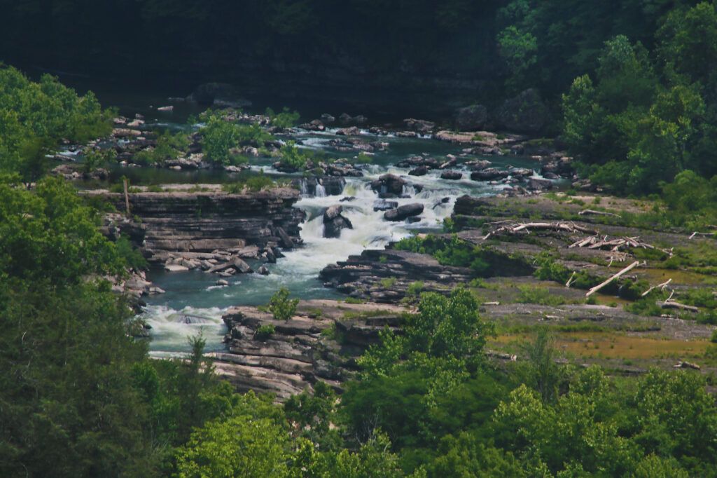
Great Falls
Great Falls is a 30 foot series of cascading waterfalls, which is visible from an overlook located at the end of a parking lot.
The water flow of Great Falls is totally dependent on the dam located inside the park. When it is open you will see more water at Great Falls, however during the dry season, when the dam doesn’t open it’s gates, it doesn’t get nearly as much water.

Badger Flat Falls
The top of Badger Flat Falls can be viewed at the Badger Flat Picnic Area. From the parking lot head toward the picnic tables located in front of the water facing the cliff face. Cross a short wooden bridge to reach the picnic tables. After crossing the bridge, take the short trail to your right. At the end you’ll see two small cascades on your right. If you go to your left and look down below you’ll see where the water flow over the edge, forming the top of the waterfall visible from the water.
If you want to see the rest of the waterfall, you can take a kayak from the beach and paddle to the bottom portion of Badger Flat Falls.
Trails
Rock Island State Park has 12 trails, three of which are accessible for mountain biking (Bluff Trail Loop, Collins River Loop and Collins Connector Trail). Trails vary in length from 0.1 miles to 2.95 miles. All the trails are marked on this map.
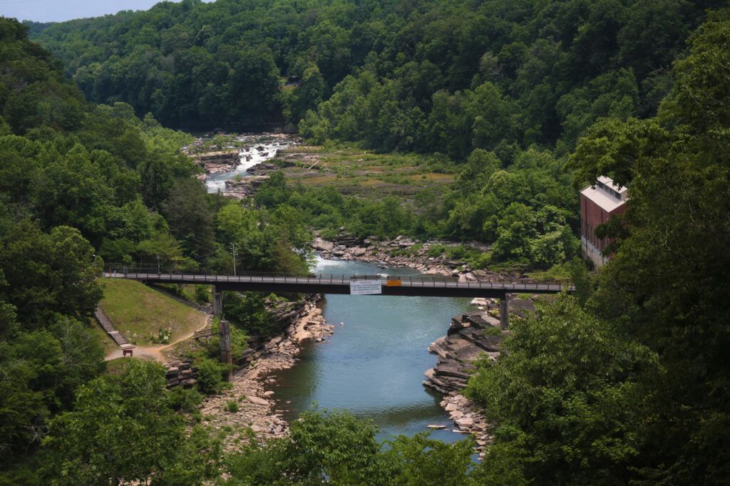
Caney Fork River Gorge
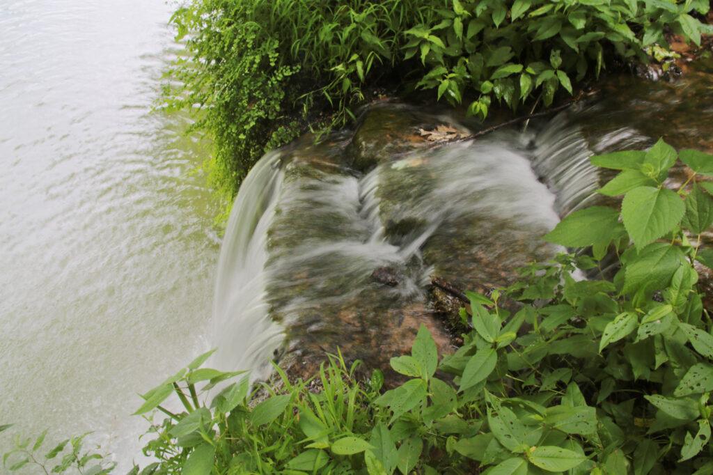
The Caney Fork River Gorge’s sheer limestone cliffs were formed by the swift currents of the Caney Fork River. The terrain in the gorge is steep, rocky and typically slick.
Swimming in the gorge can be dangerous due to hidden currents as well as frequent water releases from Great Falls Dam, which can cause water levels to rise swiftly and unexpectedly. Flash floods can occur during or after a rainstorm. If the the siren sounds or the water begins to rise, seek higher ground immediately. Over 100 people have died in the gorge over the years.
Swimming
Swimming or wading is not allowed in any of the areas located from the TVA Power House downstream all the way to the main beach boat ramp including by Twin Falls, Blue Hole and the Powerhouse due to hidden and deadly currents.
Swimming is allowed at the beach, located just past the Badger Flat picnic area, and at the following areas of the gorge:
- Great Falls – waterfall located below the Historic Cotton Mills,
- The Cold Hole – some people say this is the best swimming hole in the Caney Fork River Gorge,
- The Warm Hole – a shallow area, heated by the sun that isn’t as cold as the lake above the Great Falls Dam.
Please note that lifeguards are not staffed anywhere inside the park and swimming is at your own risk.
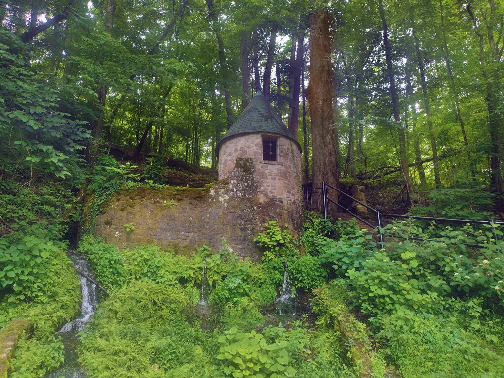
Spring Castle
The Spring Castle is a spring house built while the textile mill was in operation. It is located right across the street from the Old Mill and the parking area for Great Falls. From the road it looks like a little castle. Water collects in a reservoir behind the wall from a natural spring. The water comes out from three different ways: natural cascade, white pipe, and a faucet. Inside the Castle was a hand pump. Originally the Spring Castle provided water to the mill and surrounding houses for everyday use as well as fire protection.
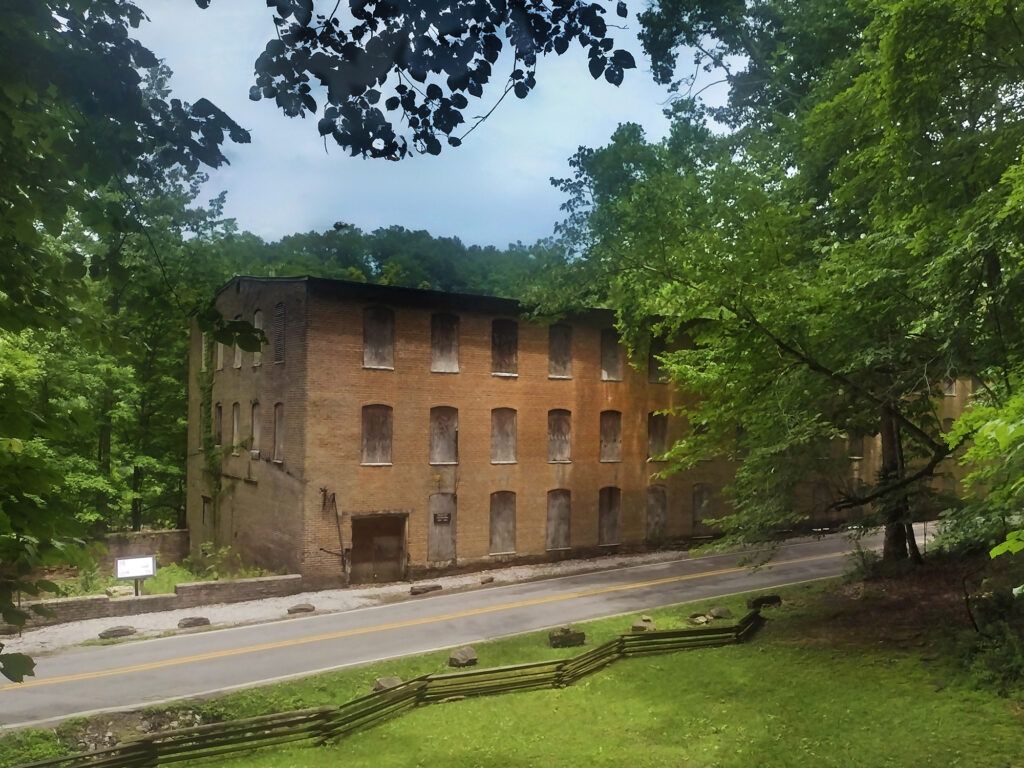
The Old Mill
The mill, which was built on the banks of the Caney Fork River in 1892,was in operation until 1902, when its wheelhouse was destroyed by a flood. The mill was known for heavy sheeting. While you can’t go inside you can view the mill from the roadside.
Camping
Rock Island State Park has 60 campsites, each equipped with electric and water hookups, grill, and picnic table. There are three bathrooms (with hot water showers) located in the camping area. Campers must register at the park office. Campsites can be reserved online up to one year in advance, with the maximum stay of two weeks. Tent camping is also allowed. The campgrounds are open year round.
Leave a Reply