Southeast Waterfall & Hiking Guide

Your Hiking Guide to Waterfalls and more in the Southeast US

  • Home
  • About
  • Ease of Trail
    • Roadside
    • Wheelchair Accessible
    • Easy
    • Moderate
    • Strenuous/Hard
  • Fall Location
    • Georgia
    • North Carolina
    • South Carolina
    • Kentucky
    • Tennessee
    • Virginia
  • Waterfall Trips
    • Day Trip
    • 3 to 5 Day Trip
  • Area Attractions
    • Bridges
  • Hiking
  • Blog
    • News
    • Photography
  • Terms to Know
Home Trails Cedar Rock Falls

Cedar Rock Falls

Posted on May 22, 2016 Written by Leave a Comment

Nearby Areas: Brevard, Pisgah National Forest   State: North Carolina   Ease of Trail: Moderate

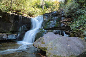
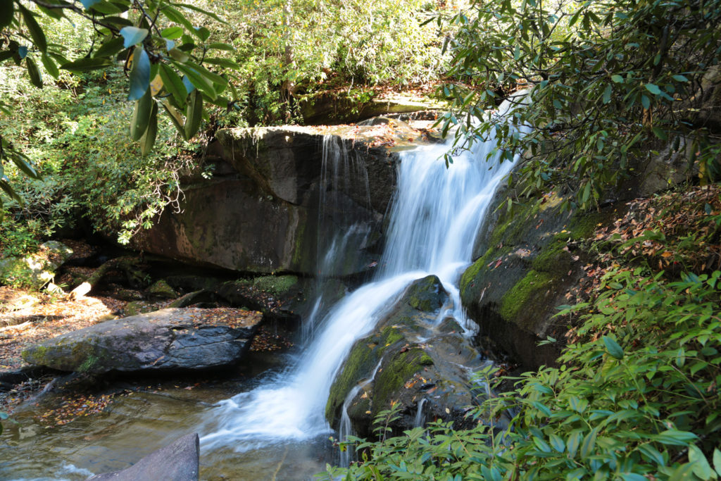
Cedar Rock Falls 2If you are looking for a tranquil waterfall that isn’t over-run with lots of people – then Cedar Rock Falls is just what you are looking for! This is not the easiest waterfall to find, however it is worth the effort. It is only 20 feet tall, but what it lacks in height, it makes up for in beauty.

Many people list this waterfall as easy, but I would classify it as a moderate simply because you do venture off the main trail into a section that isn’t maintained. When we visited this waterfall we had to shimmy over two fallen trees and down some slippery rocks to get to the base of the waterfall.
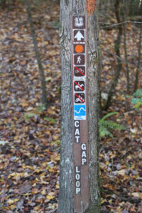
Cat Gap Trail Sign

To access Cedar Rock Falls, go to the Pisgah Center for Wildlife Education parking area. Go to the left of the Pisgah Center and there will be a gated road. Cross through the gate and you will come to Cat Gap Loop Trail up ahead on your right.

Follow the orange blazed trail for about a third of a mile. Cross Cedar Rock Creek on a footbridge. After crossing the creek, keep to the right up the bank on Cat Gap Loop Trail and continue following the orange blazes. Continue hiking for another 10-15 minutes and start looking for a side trail on your left.
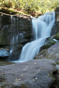
Cedar Rock Falls 3It is tricky to find so be sure to listen for the waterfall and look closely for the side trail. It is easy to miss if you aren’t paying close attention. The side trail should be about 0.7 miles away from Pisgah Center.

Keep following the sound of the waterfall and you’ll reach a rocky wall. You need to climb down to the base of the waterfall for the best view. Be careful on the rocks in front of the waterfall because they can be slippery.

There are many waterfalls nearby including: Looking Glass Falls, Moore Cove Falls, Slick Rock Falls, Log Hollow Falls, Upper Log Hollow Falls, Daniel Ridge Falls, Graveyard Fields and Skinny Dip Falls.
Cedar Rock Falls 1

Share:

  • Share on Facebook (Opens in new window) Facebook
  • Share on X (Opens in new window) X
  • Share on WhatsApp (Opens in new window) WhatsApp
  • Share on Pinterest (Opens in new window) Pinterest
  • More
  • Share on Tumblr (Opens in new window) Tumblr
  • Share on Reddit (Opens in new window) Reddit
  • Print (Opens in new window) Print

Like this:

Like Loading…

Related

Directions

From the intersection of US 276 and US 64 in Brevard, go north on US 276 toward Waynesville, NC. Drive 5.2 miles and turn left onto FS 475. Continue on FS 475 for 1.4 miles and turn left into the Pisgah Center for Wildlife Education parking area. To get to the trail head, go to the left of the Pisgah Center and there will be a gated road. Cross through the gate and you will see Cat Gap Trail up ahead on your right.

GPS Coordinates

To the Waterfall:35.278110°N, 82.799697°W

Nearby Areas: Brevard, Pisgah National Forest

State: North Carolina

Ease of Trail: Moderate

Leave a ReplyCancel reply

Recently Added Waterfalls

  • Bullpen Cove Falls
    State: North Carolina
    Trail Ease: Roadside
  • Buffalo Springs Falls
    State: Tennessee
    Trail Ease: Easy, Roadside
  • Glen Falls
    State: Tennessee
    Trail Ease: Moderate
  • Vickery Creek Falls/Dam
    State: Georgia
    Trail Ease: Easy
  • Waterfall Park (Dalton, GA)
    State: Georgia
    Trail Ease: Easy

Recently Added Trips

  • Rutledge Falls at the base
    Explore Ten Waterfalls In a Day In This Tennessee Waterfall Road Trip
  • The Sinks 2
    Smoky Mountain Roadside Waterfall Day Trip
  • Little Egypt Falls
    Wartburg Area Waterfall Day Trip
  • Rutledge Falls at the base
    Tullahoma Family Friendly Waterfall Day Trip
  • Lower Greeter Falls in the Spring
    South Central Tennessee 3-5 Day Trip
  • Full length of Pine Ridge Falls
    Erwin Area Waterfall Day Trip
  • Upper Falls Graveyard Fields
    Blue Ridge Parkway to Highlands Road Trip

Fall Trails by Difficulty

  • Easy (111 trails)
  • Moderate (43 trails)
  • Wheelchair Accessible (10 trails)
  • Roadside (43 trails)
  • Strenuous (9 trails)

Waterfalls by State

  • Georgia (8 trails)
  • South Carolina (9 trails)
  • North Carolina (48 trails)
  • Tennessee (76 trails)
  • Virginia (9 trails)
  • Kentucky (4 trails)

Copyright Info
Privacy Policy

Supporting the Site
Disclaimer & Info
About the Authors
Wesite developed by Waltdesign & Development.
%d