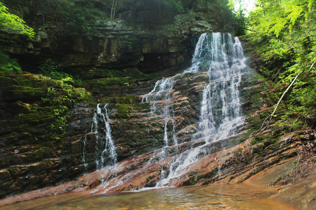
 Margarette Falls, sometimes called Marguerite Falls, is a beautiful fan-shaped, 60-foot waterfall, located in Cherokee National Forest in Greene County, TN. It is one is of the most popular waterfall trails in the area. This trail is rated moderate due to the steep elevation gain of 668 feet and rocky parts of the trail over sharp and uneven rocks that last 0.1 to 0.2 miles in length and can be difficult to walk on, especially after it has rained and the trail is a little slippery.
After parking in the large Margarette Falls parking lot, you’ll start by following a closed Forest Service road for the first 0.5-miles. This part of the hike is easy and level over gravel. Shortly after leaving the road the trail forks, bear left onto Bullen Hollow Trail, which has blue diamond blazes and hike along Dry Creek. Dry Creek drops down the gorge in a series of small cascades and waterfalls for the entire distance. This trail is well marked and easy to follow.
From the point where the trail forks it is 0.7 miles to the waterfall. There are many little off shoots to see the cascades and plenty of small “waterfalls” about 8 to 12 feet in height. There are also some interesting rock formations on the way as well. It is a very pretty hike, so don’t just blow past the sights just to get to the “main event” quicker.
You’ll be hiking pretty much at an incline for much of the rest of the hike. The difficulty increases gradually so if you get to a point you can’t manage, you can stop knowing its going to get more difficult as the trail continues. I recommend a walking stick and good hiking shoes. There are several spots where you are literally hiking on top of sharp and uneven rocks, which can be challenging in some parts. There are also a few narrow parts that you’ll want to move off to the side early if you see another hiker coming from the opposite direction, as passing is difficult.
There is one creek crossing that is not over a bridge. It is ankle to mid-calf deep, depending on the recent rainfall. My kids and I had no difficulty crossing due to some well placed rocks and a log to cross on. With our hiking poles, we didn’t even get our shoes wet.
Margarette Falls is impressive and has a nice watering hole in front. The trail will take you right up to the base of the waterfalls. Since this is an out-and-back trail, once you’ve visited Margarette Falls, you will return the way you came back to the parking lot. This waterfall has a large parking lot, which is an indication of the traffic to and from this waterfall so go early and/or on a weekday to avoid crowds.
If you are an experienced hiker used to strenuous trails, bushwacking and trails where scrambling is required, then you might want to continue onto Bailey Falls. DO NOT continue this part of the hike alone or with an inexperienced hiker.
Leave a Reply