Looking for roadside waterfalls in the Smoky Mountains? Here’s a day trip with just over an hour of drive time to eight roadside waterfalls all located inside the Smoky Mountains. Most of these waterfalls are wet-weather waterfalls and are best viewed after a lot of rain or during the Winter and Spring months.
For more information about these waterfalls, just click the links on each individual waterfall.
Please note that waterfalls in Brevard are not included, while near the Smoky Mountains, are actually part of the Blue Ridge Mountains.
Whiteoak Flats Falls
After driving through the Townsend entrance to the Great Smoky Mountains National Park, a short distance away you’ll come to a fork in the road. Going toward the right takes you to Cades Cove and going to the left heads toward the other park entrance and Gaitlinburg. Head to your left and drive about 0.6 miles. Whiteoak Flats Branch Falls is located on your right side. It is clearly visible from your car as you drive past it.
There is no parking area beside the waterfall so you’ll need to pass the waterfall until you reach a place where you can safely turn around and park at a nearby pull off on the left side of the road.
From your car you cannot see the entire waterfall. The waterfall is smaller at the top and gets larger as it gets closer to the road. It’s about 20 feet tall and is in sections going down toward the road and continues under the bridge.
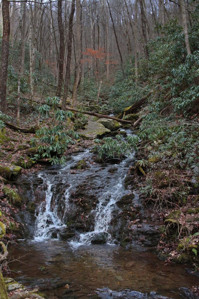
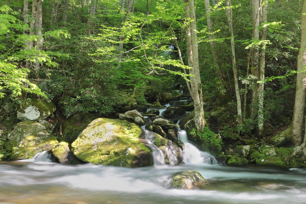
Meadow Branch Cascades
It’s really easy to miss seeing Meadow Branch Cascades from your car because it’s on a curve and you have to look down to see it, so I’d recommend you put it into your GPS to find it. There is no parking by the waterfall so you’ll need to pass the waterfall and park near the tunnel along Laurel Creek Road and then walk to it following the West Prong Little River.
You are able to view the waterfall from the side of the road. There is a decent space along the side of the road across the waterfall where you can look at it from the roadside.
I’m told there is a steep dirt path that leads downhill about 20 feet to the water’s edge where Meadow Branch Cascade is visible across the river but have not tried it.
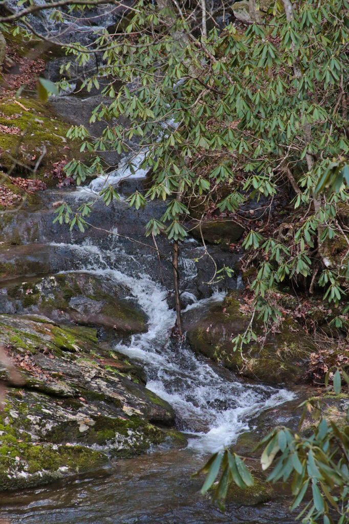
Cane Creek Twin Falls
Cane Creek Twin Falls isn’t the easiest to locate, so I’d recommend you enter it into your GPS to find it since it isn’t easy to see from the road. The waterfalls are below road level, but you can see them from the parking area. There is a small parallel parking area located on the side closest to the river on Little River Gorge Road right at the waterfalls. There is no pull off parking for eastbound travelers.
The Twin Falls aren’t readily visible through the leaves most of the year. However, what these falls lack in water volume, they make up for in being a great swimming hole. Since there is only enough parking for 2-3 cars, it doesn’t get too busy (unlike the Townsend Wye, which is located just down the road). You can view Cane Creek Twin Falls from the parking pull off. There is a rocky path from the pull off that goes down to the water’s edge in front of the waterfall.
This waterfall is best visited during the winter or early spring months before all the leaves come in to ensure the best view and water flow. It is also pretty in the fall when the leaves have changed.
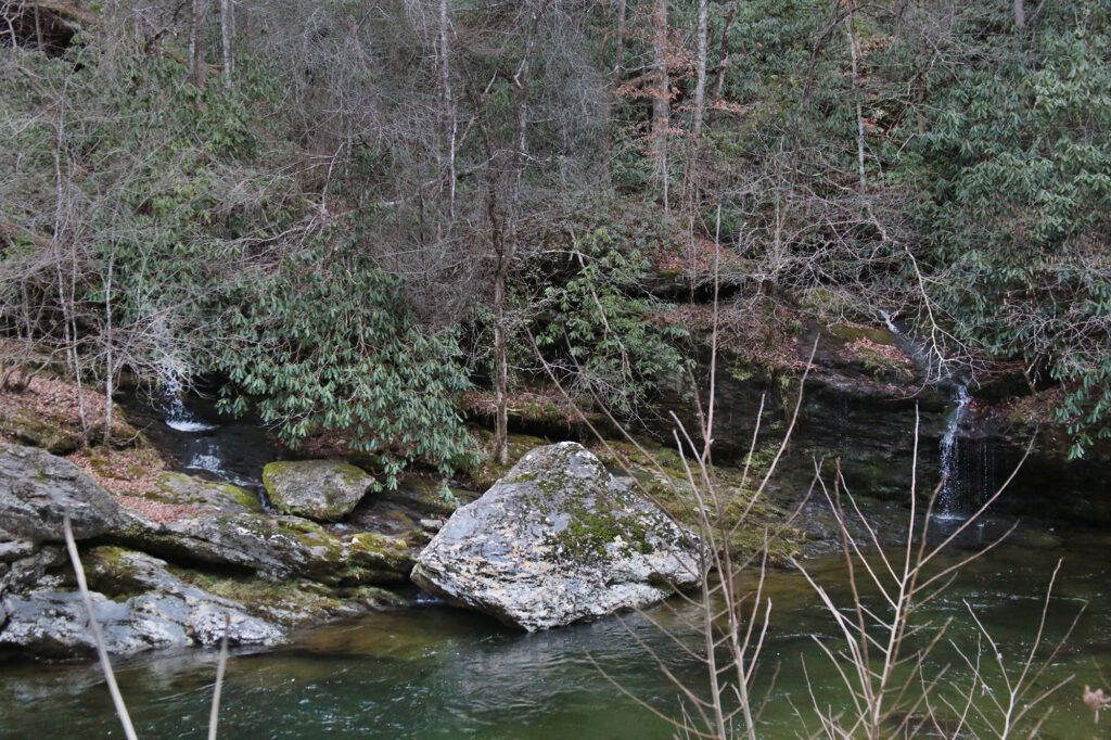
Meigs Falls
Meigs Falls is a 30 foot waterfall that can be seen from a pull-off on Little River Road between Cades Cove and Sugarlands Visitor Center. The view is partially obstructed by trees in the summertime; otherwise the view is good, if not great. This waterfall usually has a lot of visitors, but it has a very large pull-off so you should be able to find a place to park.

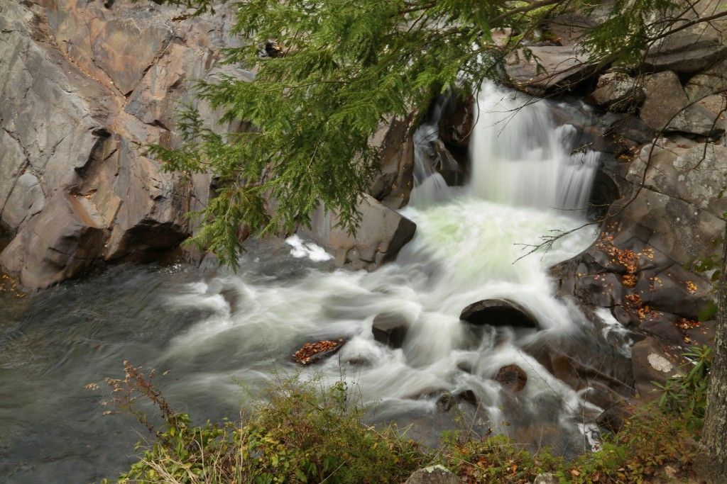
The Sinks
The Sinks is a pretty waterfall that is very easy to access. It is a small waterfall that includes the entire flow of Little River. You can walk right up to a close-up overlook to the waterfall right from the parking lot. This one is my favorite waterfall of this trip. The walkway from the parking area is paved so it is wheelchair accessible.
Swimming near The Sinks can be dangerous and is not recommended by the Park. If you want a swimming area, I’d recommend The Wye (located near Townsend and Cades Cove), which you will pass on the way to this waterfall if you’re following this day trip.
Mannis Branch Falls
Mannis Branch Falls looks to be between 25-35 feet in height and flows into Little River inside the Great Smoky Mountains National Park. However most of the year a large portion of the waterfall is blocked by foliage. If you hope to get a good view of this waterfall I would recommend the end of Fall after the leaves have changed and started to fall off the surrounding trees or in the Winter when all the leaves have fallen.
To get to Mannis Branch Falls, head toward Elkmont Campground. Just a short distance away there will be a paved pulloff for you to park at. Follow the roadside. Look for a fisherman’s trail about 50 yards away from the parking area and make your way down the short trail to Little River. Across Little River you should see Mannis Branch Falls.
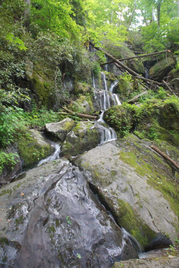
The Place of a Thousand Drips
The Place of a Thousand Drips is a wet weather waterfall, located on the Roaring Fork Motor Trail near post #15, that can be seen from your vehicle. It’s name is quite fitting. After a good rain it can be quite dramatic as the flow of water splits into many small bands of water cascading around the rocks and creates a “thousand drips”, however if there hasn’t been a good rain recently it is reduced to trickles and you’ll drive right past it without even knowing it was there (even when you are looking for it).
The Place of a Thousand Drips starts at the top with high rocks and a small cave and cascades down 30 feet. The waterfall is unusual due to the interesting grooves and channels worn into the rocks over time creating intricate pathways that split apart and rejoin many times on the way toward the bottom of the waterfall.
Note: The map will take you to the Roaring Fork Motor Trail. The Place of a Thousand Drips is located at the end of the 6 mile motor trail near post #15. There is a parking area right after you pass the waterfall.
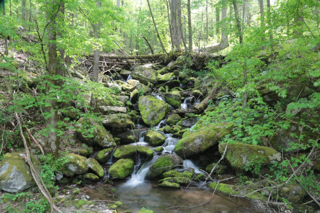
Noisy Falls
Noisy Falls is a roadside waterfall near Cosby. There may not be much water flow on this waterfall, but it is still pretty to look at. The total height is between 20-30 feet.
This waterfall is located near the Greenbrier area of the Great Smoky Mountains National Park. Noisy Falls looks best after a good rain which dramatically showcases the flow of water splitting into intricate pathways that cascade around the rocks causing a spiderweb effect on the way down toward the bottom of the waterfall. However if there hasn’t been a good rain recently it is reduced to trickles of water and you’ll drive right past it without even knowing it was there (even when you are looking for it).
Noisy Falls is located 5.7 miles east of the Greenbrier junction along U.S. 321. Park at a small unsigned grassy shoulder just wide enough to park along the north side of the road. It’s just beyond (east) of the private drive named Noisy Falls Lane.
Noisy Falls isn’t listed on Google Maps, so I entered the nearby Smoky Bear Campground, which is around two miles after you’ve passed the waterfall. If you follow the directions above, you’ll see it on your right side.
If you pass it, turn around drive pass the Campground for two miles and then you’ll see a sign for Pittman Center right before you come to a bridge. Park in the grassy area just before you reach the bridge in front of the sign. The waterfall is located at the bridge on the opposite side of the road.
Good trip. I love waterfalls. My family enjoy going to. I want to do this summer.
My mother has a hard time walking. I’ve been looking for something like this for so long. I love hiking to waterfalls and always wanted to share them with her, but due to her health this is not an option. This trip will allow me to share my passion with her in a way I’ve never thought possible. Thank you so much!