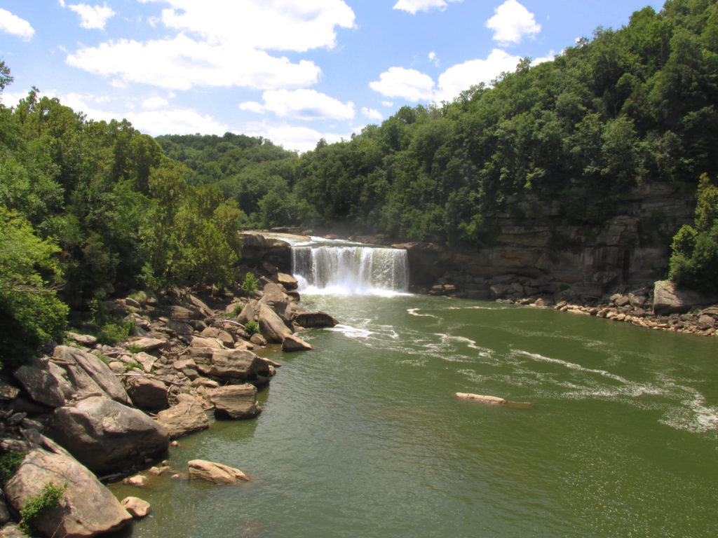
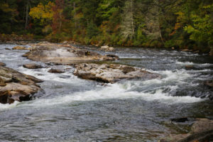
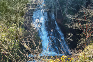
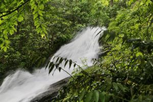
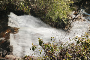
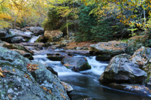
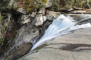
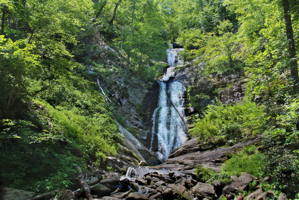
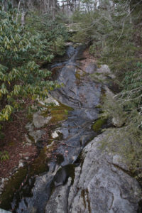
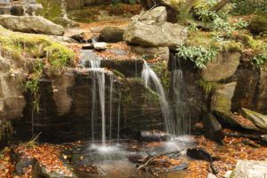
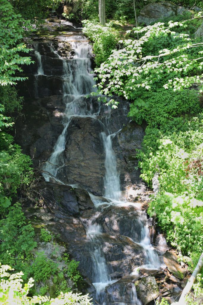
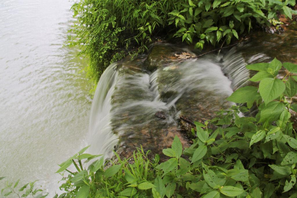
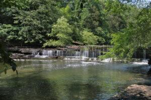
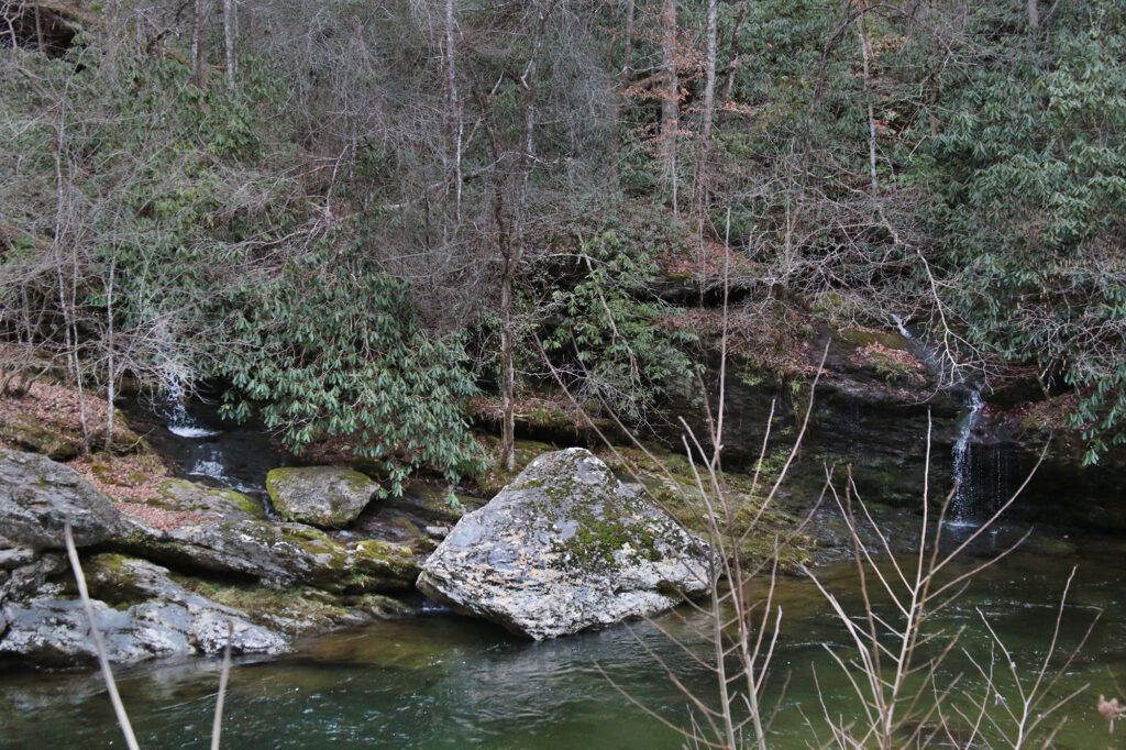
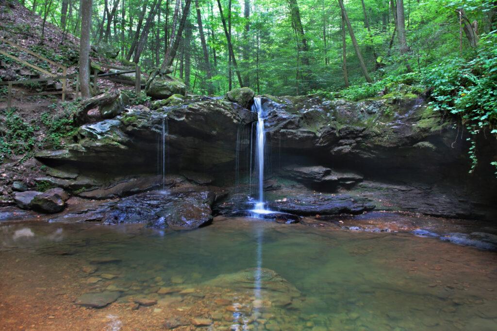
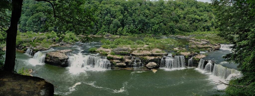
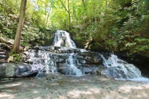
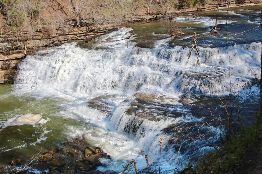
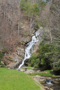
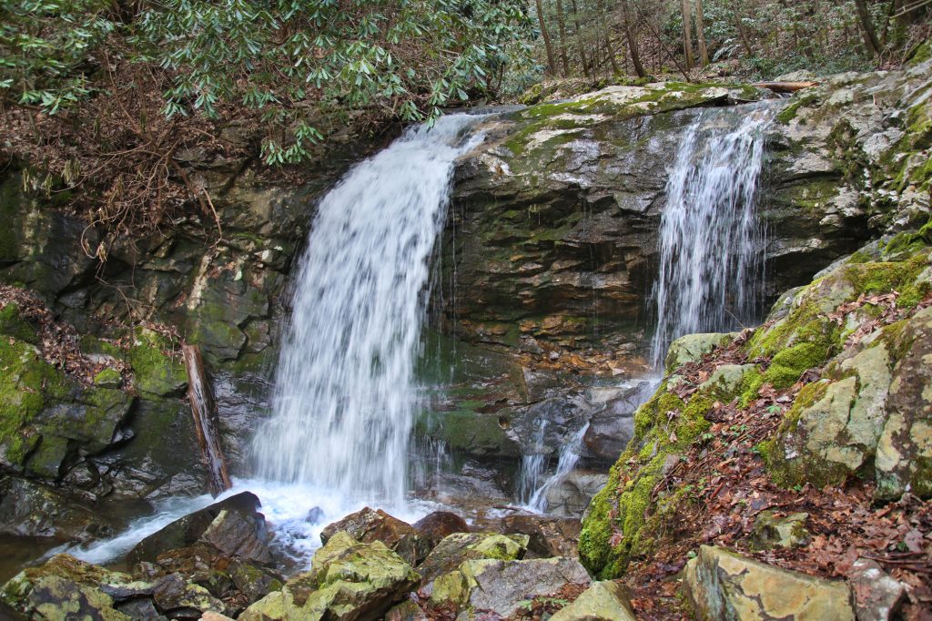
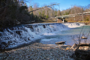
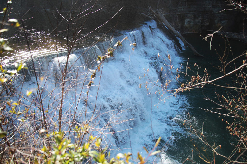
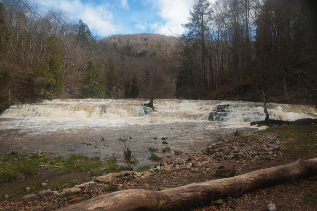
 Bull Sluice Falls is more of a rapids, rather than a waterfall, however it is still quite pretty to see. Bull Sluice Falls is located on the Georgia and South Carolina border on the Chattooga River. This waterfall was featured in the film Deliverance.
Be sure to park on the South Carolina side. Follow the paved trail to the left of the Information Station. Then turn right onto the gravel trail and follow it to the observation platform. The trail is a very easy 15 minute walk on a paved trail that will take you to an observation platform. To return to your car, simply turn around and go back the way you came.
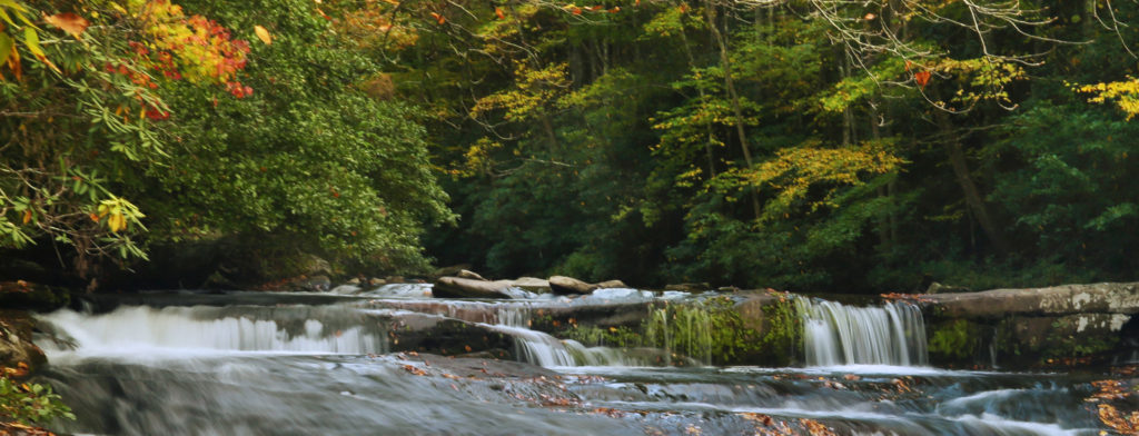
 There is also another trail that will take you to the water’s edge downstream from the rapids, which can be fun to skip rocks at.
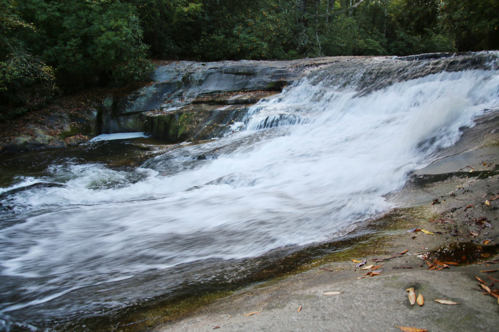
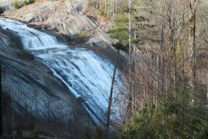
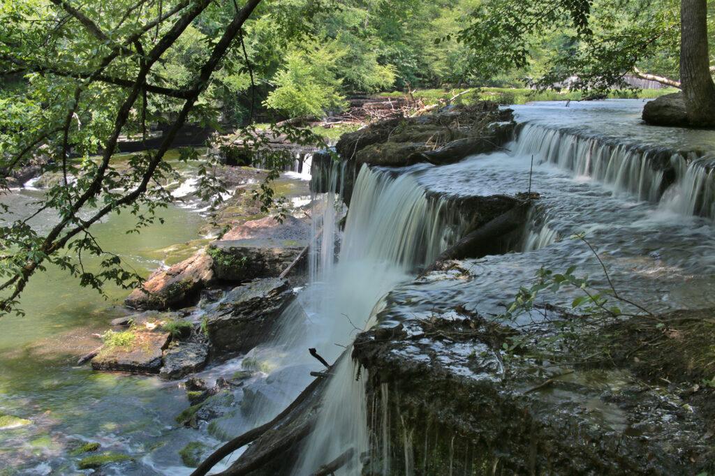
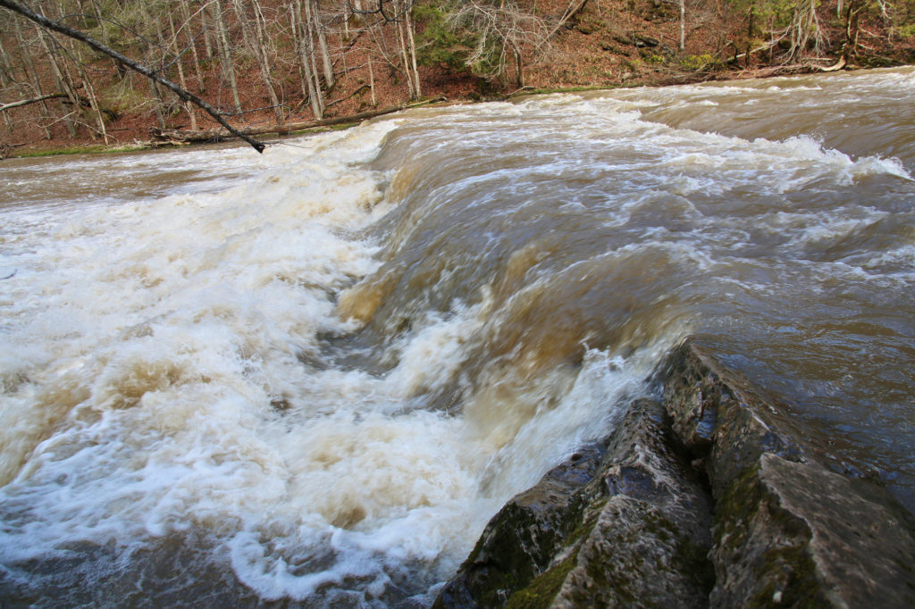
Kayakers and rafters can frequently be seen running this IV+ rapid, which drops 14 feet. We saw several groups both shooting the rapids as well as scouting in advance while we were visiting Bull Sluice Falls.
There is plenty of parking and restroom facilities available, making this a very family friendly stop.
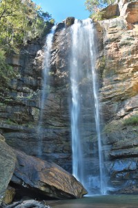
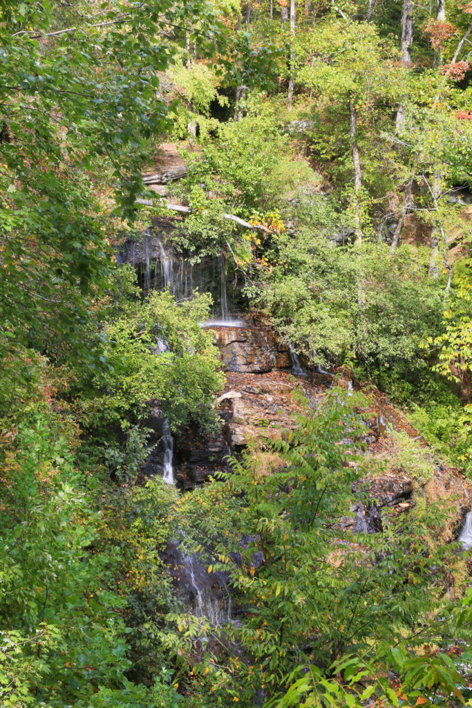
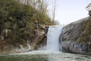
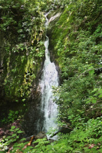
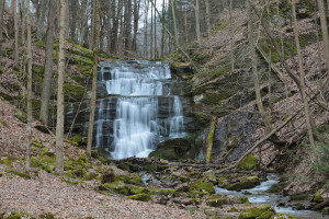
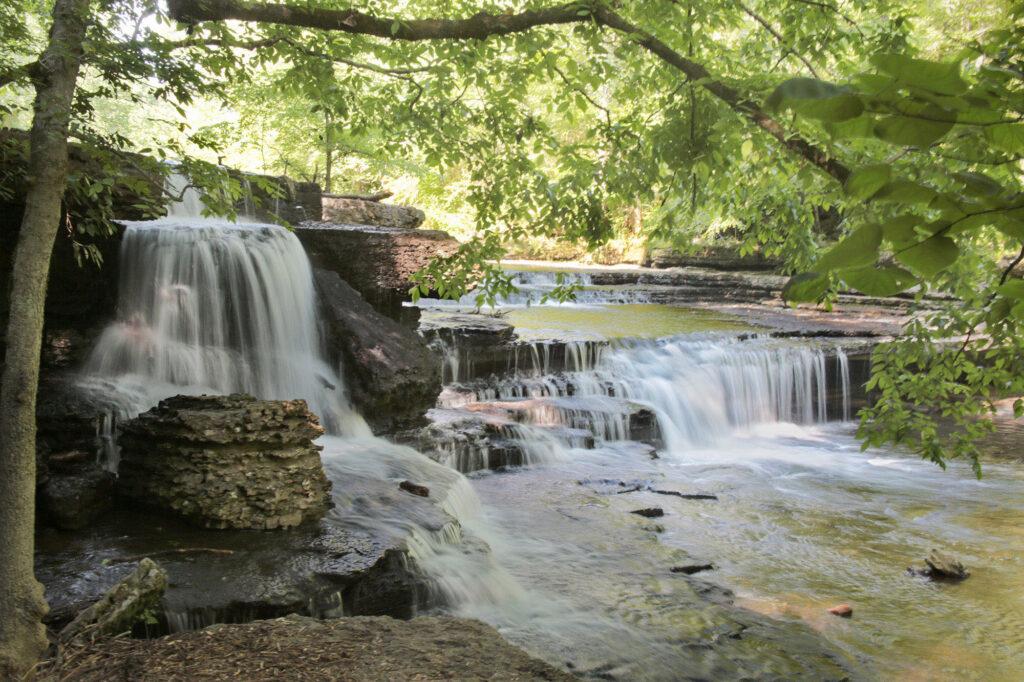
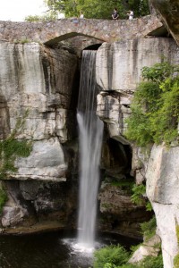 Love this waterfall! It is inside Rock City, however you can view the falls without going to Rock City. This being said, I still highly recommend going to Rock City as there is so much to do there including nature trails, and caves with stories told in miniature models.
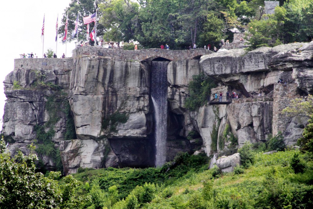
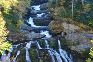
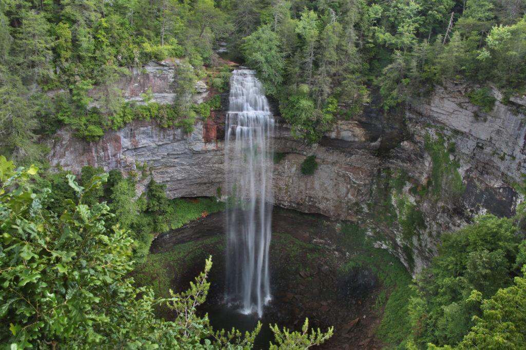
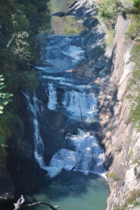 Tallulah Gorge is two miles long and nearly 1,000 feet deep. Multiple trails around the park take you to several overlooks. There are several impressive views of the gorge and it’s waterfalls.
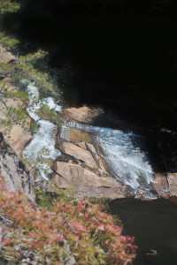
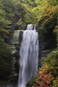
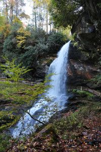
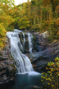
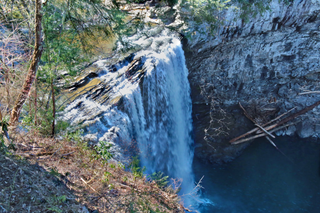
 Toccoa Falls is located in Stephens County, Georgia on the campus of Toccoa Falls College. The waterfall has a 186 feet vertical drop, making it one of the highest free-falling waterfalls east of the Mississippi River.
 Toccoa Falls is open year round and a $2 fee.
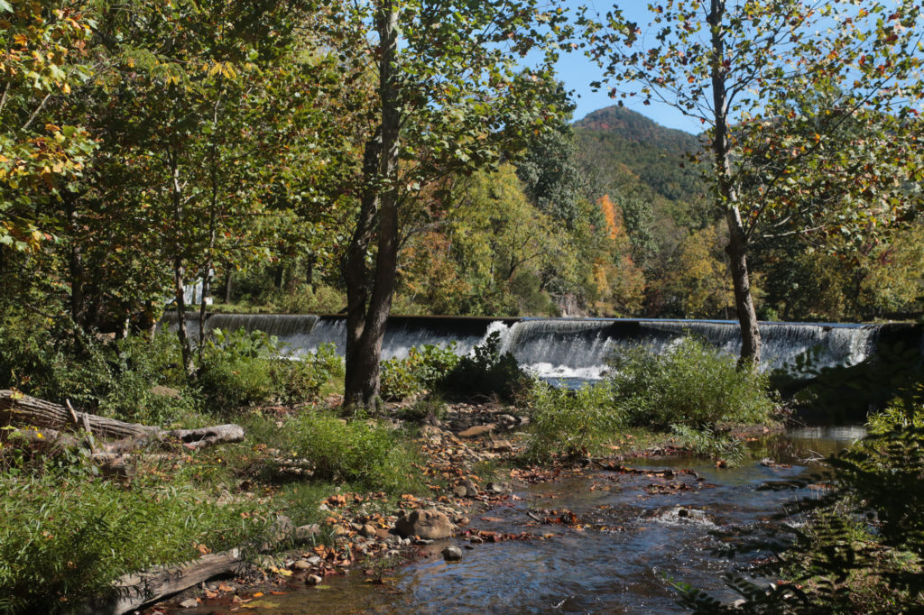
 Cedar Falls is located inside Cedar Falls park in Greenville County. This area is rich in both history and beauty. The Reedy River at this point widens to over 200 feet, cascading over rocks to create a beautiful and picturesque waterfall.
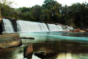 During the early 1800s this site was used for generating power for several mills and a cotton gin by building a small dam on the side channel of the river. Around 1910 a large dam was built across the entire river to produce electrical power for Fork Shoals Mill.
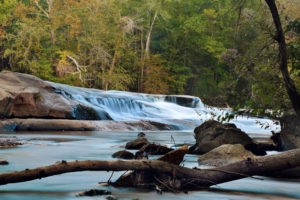 There’s also picnic areas and a really nice playground if you want to spend a day with the family at the park. If you are in the Greenville area, you may want to add this to your list of things to do in the area.
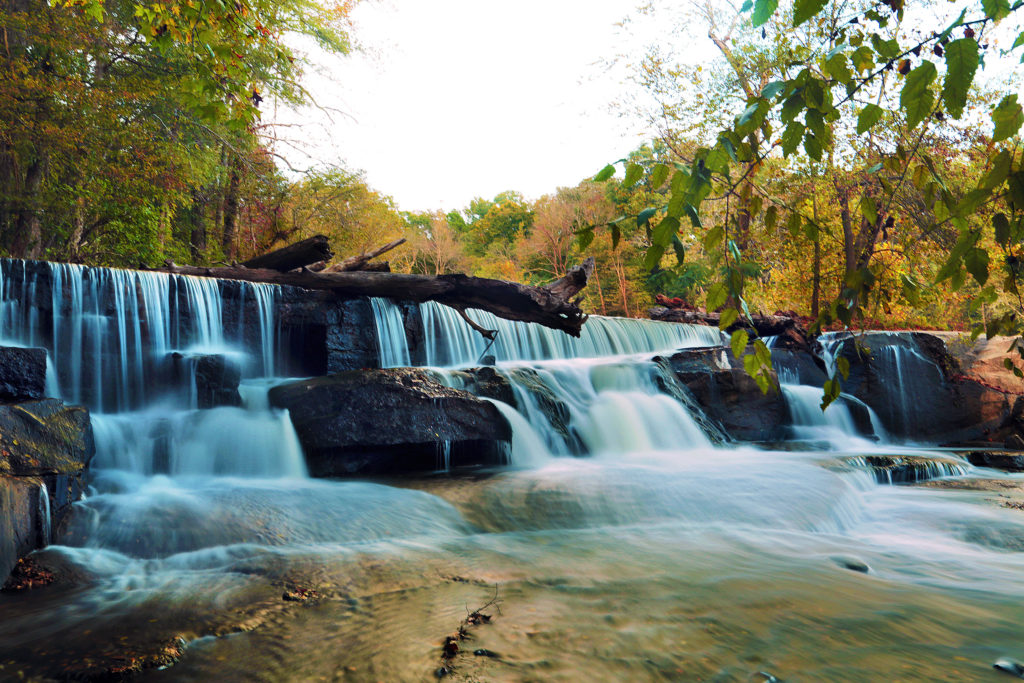
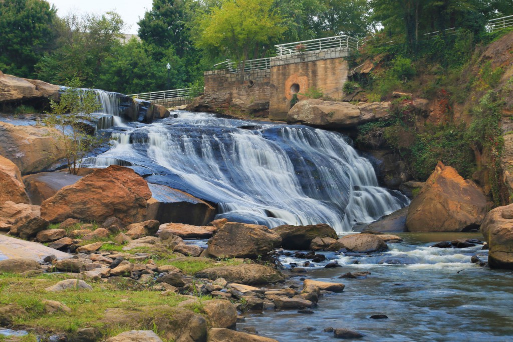
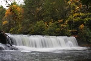
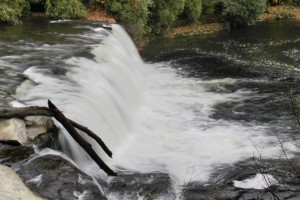
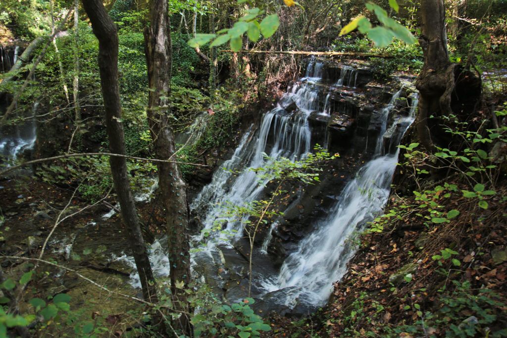
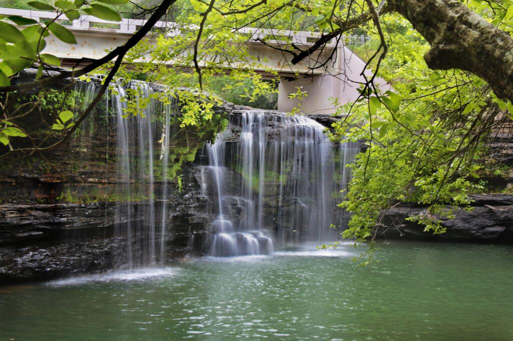
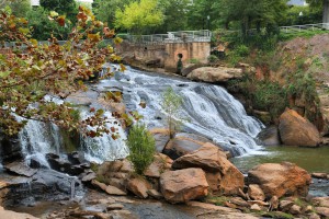 Reedy River Falls is located right in downtown Greenville, South Carolina in Falls Park. Falls Park is a 26 acre park with a waterfall, trails, wooden swings and Liberty Bridge (a large suspension bridge which is amazing to look at in the evening). Reedy River Falls is a 40 foot waterfall. Reedy River Falls is actually made up of three separate waterfalls with several smaller cascades surrounding the waterfalls.
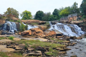
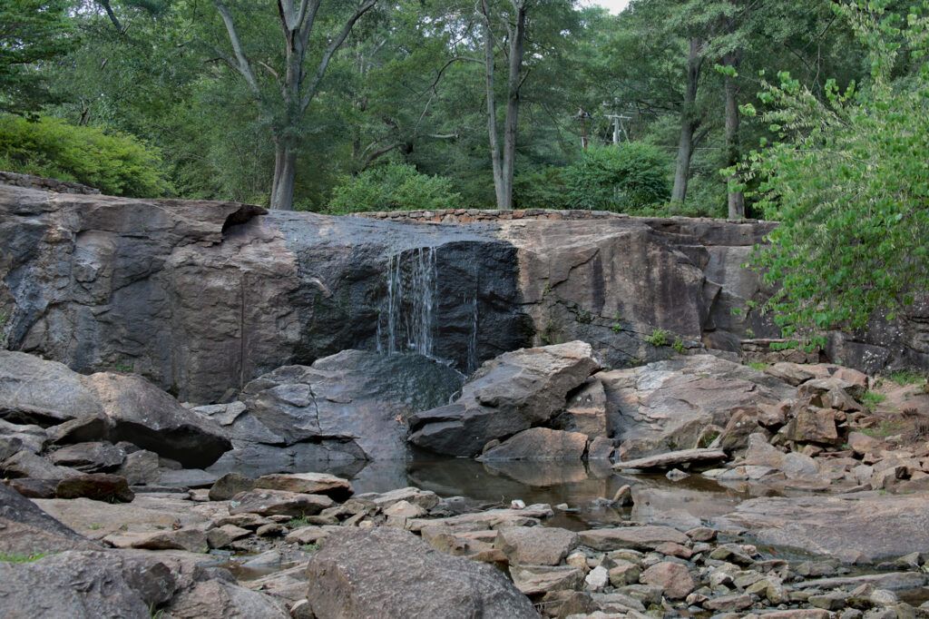
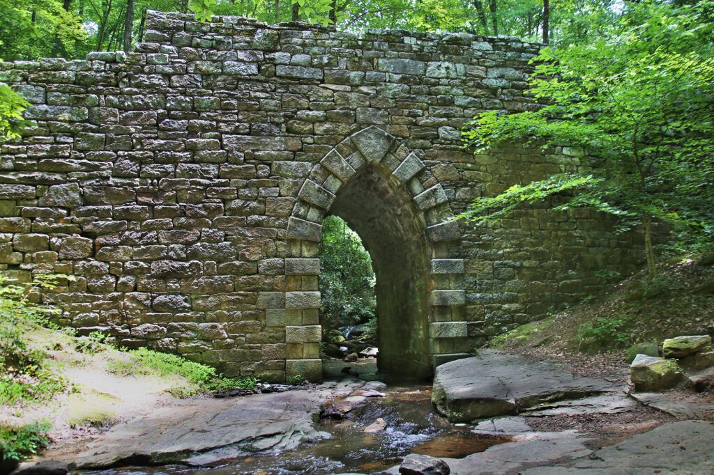
 In 1929, the Greenville Garden Club purchased the two acre abandoned pre-Civil War granite rock quarry. The Garden Club planned to preserve and beautify the land. First they removed rocks that were choking off its water source, Town Spring. This created a small creek. Using the extra quarry stones, the Garden Club was able to create a stone bridge and steps leading down into the newly created garden.
  Station Cove Falls (also known as Oconee Station Falls or Station Falls) is a 60 foot waterfall located in Sumter National Forest in Oconee County, South Carolina. The trail is an easy, 30-minute hike through the beautiful Appalachian forest, which takes you to Station Cove Falls, a stepped 60-foot waterfall. Station Creek Falls is formed from headwaters atop Station Mountain.
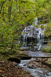 on the right. Continue 100 feet on the trail up Station Creek to the base of the falls.
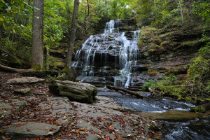
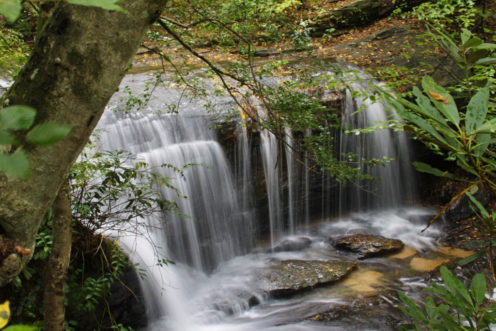
 Batson Creek Falls and its twin,
 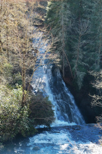 Batson Creek Falls Falls can be seen from a wheelchair accessible platform, built in 2011. You follow a short walkway from the rear of the parking lot next to of Top of the Falls Realty to the waterfall. Batson Creek Falls is the fanned cascade on the opposite side of the ravine from the platform, which is located straight in front of you. You follow a short walkway from the parking lot to the viewing platform for the waterfall.
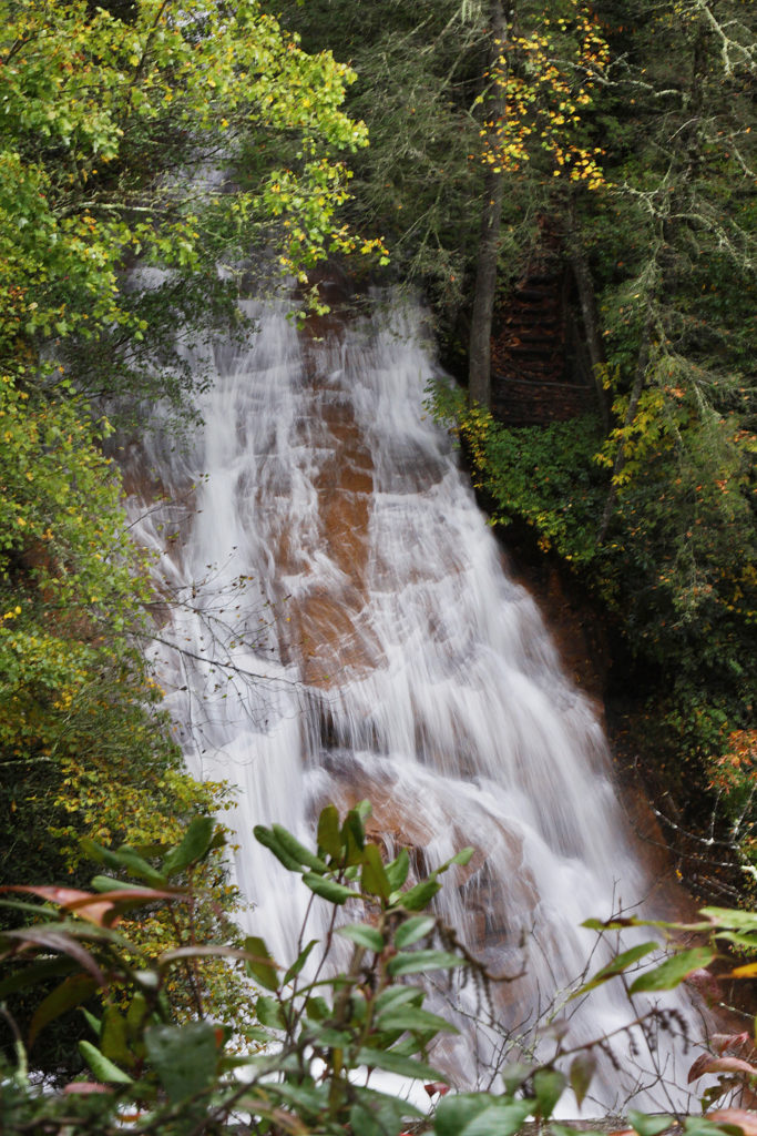
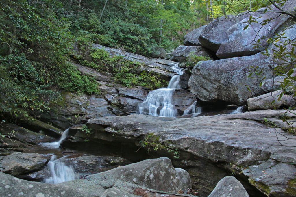
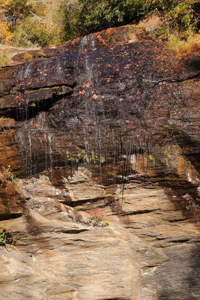
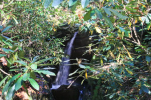
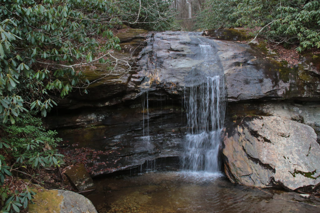
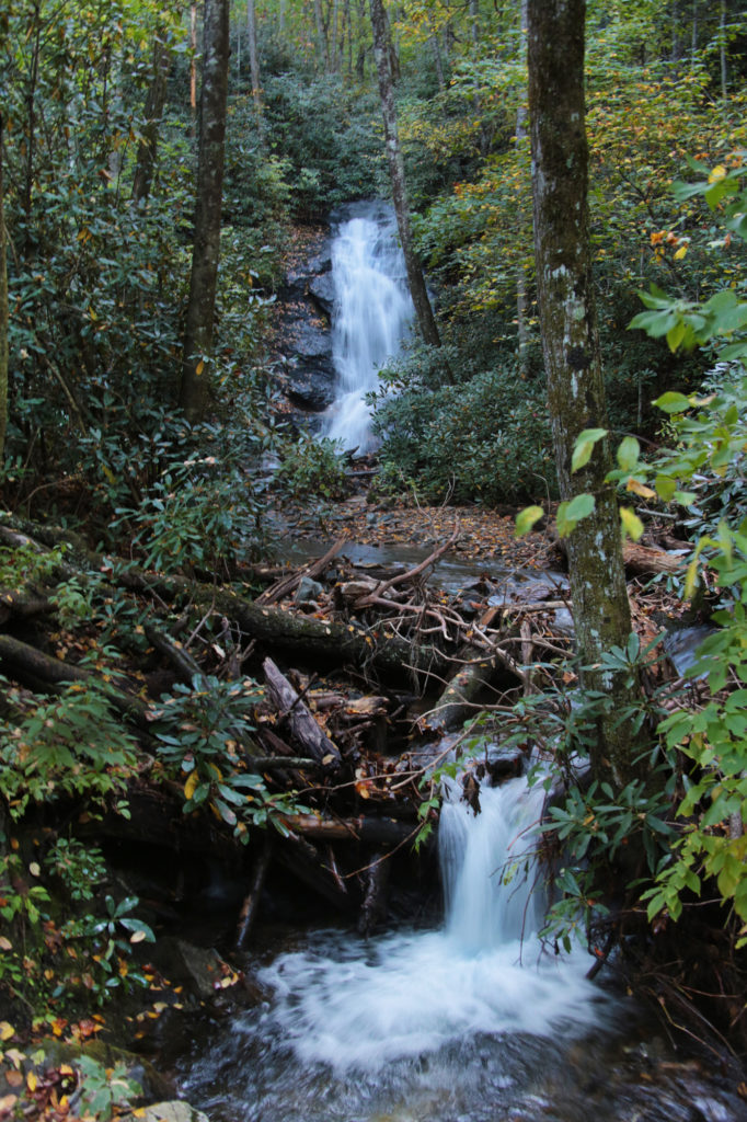
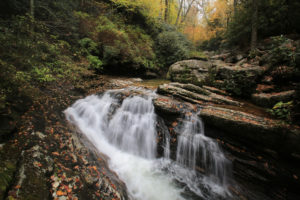
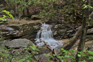
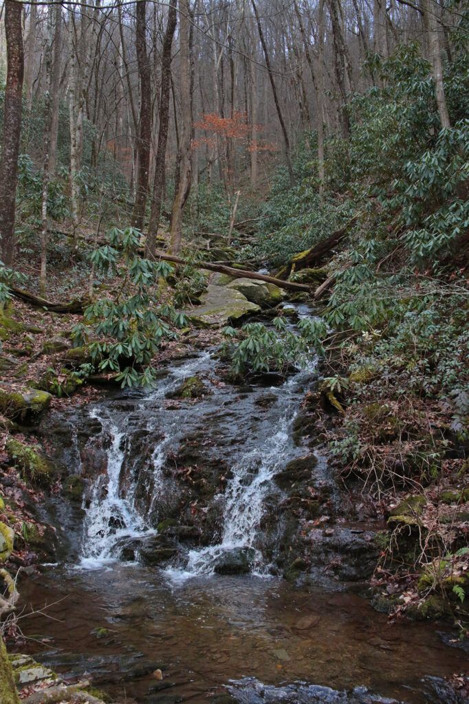
 Big Creek Falls is a small, but very pretty waterfall located in the Pisgah National Forest.If you are in the area, it’s worth stopping by to see. There is not much traffic in the area and what little we saw, drove right past it. We probably would have too if we hadn’t known where to look. The top of Big Creek Falls is barely visible from the roadway.
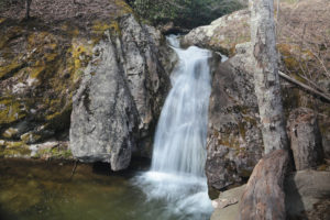
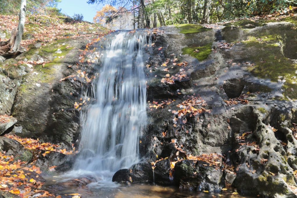
 The Cascades are located at mile post 271.9 (E. B. Jeffress Park) on the Blue Ridge Parkway. This easy 1 mile trail is perfect for the whole family.
 Descend and cross a bridge over Falls Creek. At the junction, go right down the steep steps to two overlooks for Cascade Falls. Descend 50 feet to reach the first overlook and another 200 feet to reach the second overlook. The upper overlook allows the visitors to see approximately 20 feet of cascades above the overlook and a long slide below the overlook. The lower overlook allows a different view of the slide. After it has been raining, the steps can be very slippery so take your time and be careful. The overlooks are behind stone walls. There are signs stating to not climb, sit or stand on the stone walls. These are for your safety, as people have died doing so.
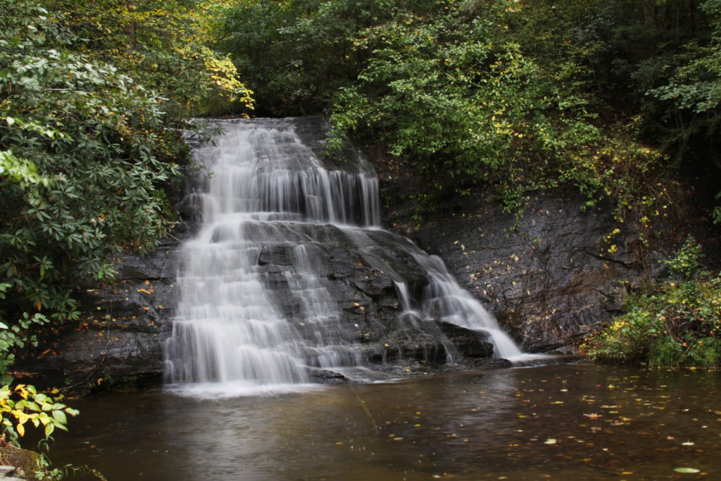
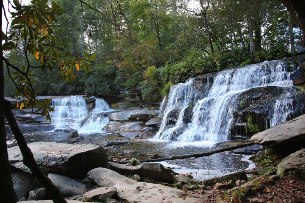
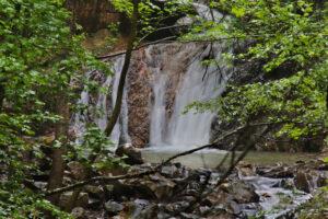
 Connestee Falls and its twin, Batson Creek Falls are located in Brevard, North Carolina. Connestee Falls was supposedly named after an Indian princess named Connestee who lost her life at the waterfall due to her relationship with an Englishman.
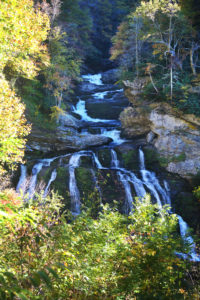
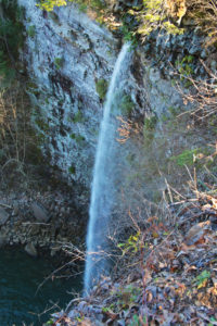
 Dry Falls is my favorite waterfall that you can walk behind. Dry Falls is 75 feet in height and is on the Cullasaja River flowing through the beautiful Nantahala National Forest. This waterfall is located in Highlands, North Carolina and has road access from US Highway 64 with a good sized parking area.
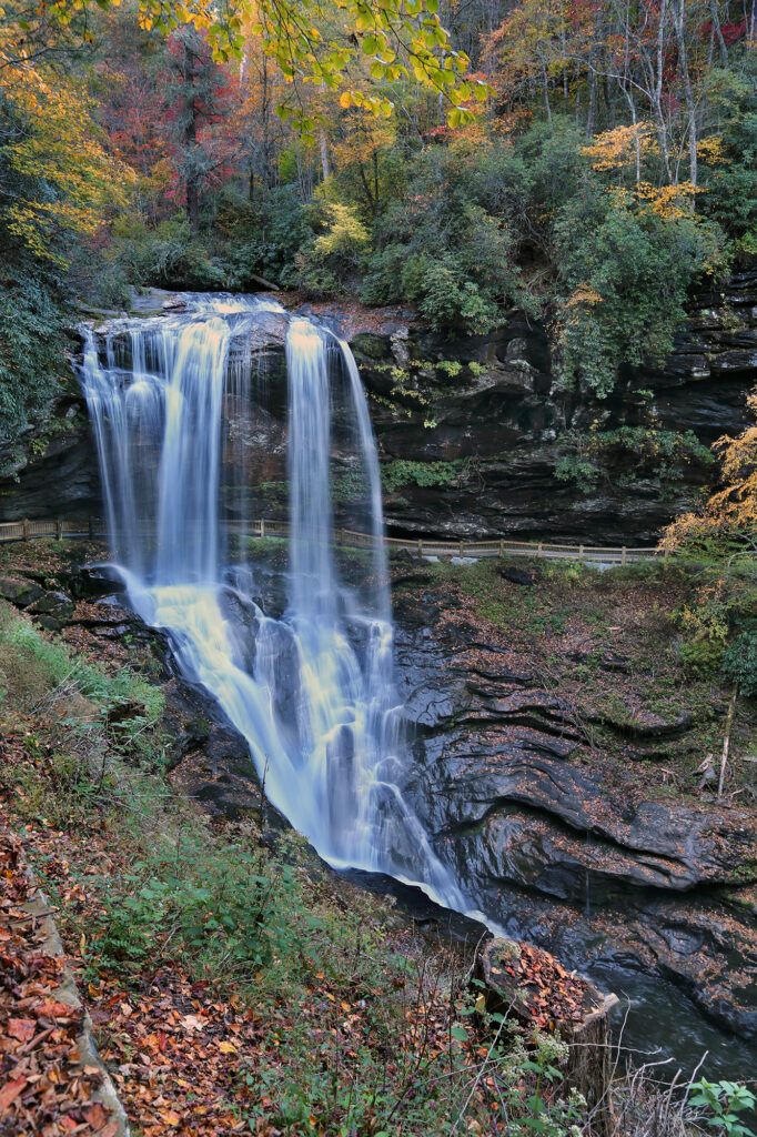
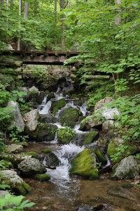
 Dugger’s Creek Falls is a small waterfall located on the Blue Ridge Parkway at the Linville Falls parking area at milepost 316.4. By itself this waterfall is not worth the effort of hiking to, however if you have time and are already there to see
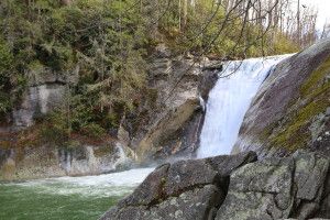
 The trail comes to a upper viewing area at the top of the waterfall in 0.25 miles. Continue on the trail for about a hundred yards and the trail descends and curves to the left bringing you to the base of the falls. You can go up the left side to get a closer look from the side of the waterfall.
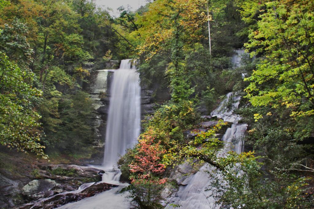
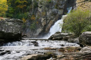
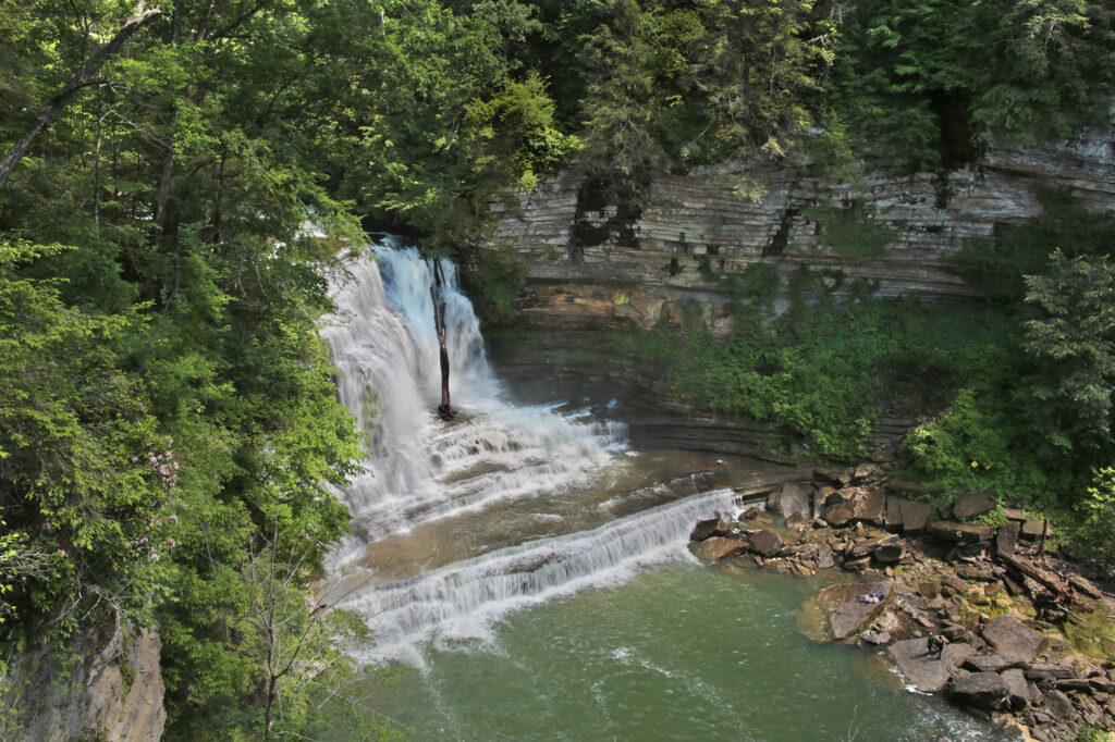
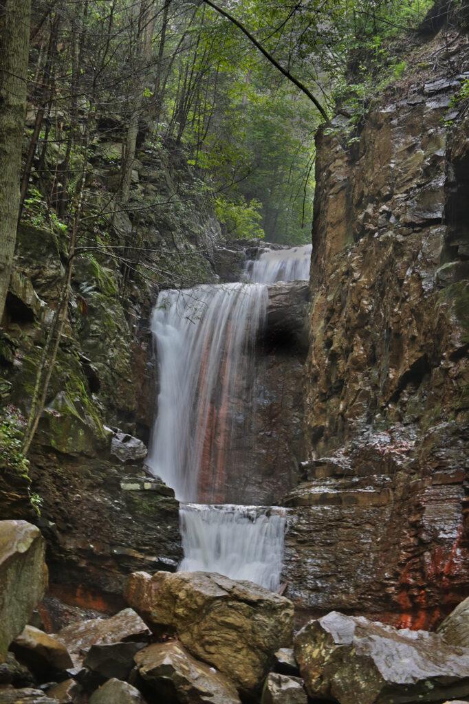
 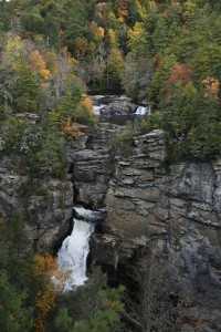 Linville Falls is located on the Blue Ridge Parkway at mile post 316.4. The total height of the falls is 150 feet with four drops. Linville Falls starts with a twin set of upper falls, moving into a small gorge, and ending in a high-volume, 45-foot drop. Linville Falls, formed by Linville River, marks the beginning of Linville Gorge. Linville River continues on after the falls ending near Lake James.
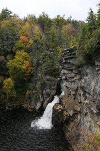
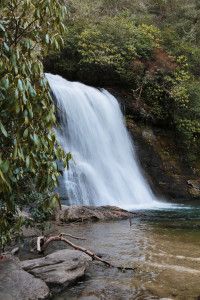
 Looking Glass Falls is a popular 60 foot waterfall located in the Pisgah National Forest near Brevard, North Carolina. It is family friendly and wheelchair accessible. There is a roadside platform overlooking Looking Glass Falls.
 Looking Glass Falls is one of the busiest waterfalls inside Pisgah National Forest because of its beauty and its ease of viewability.
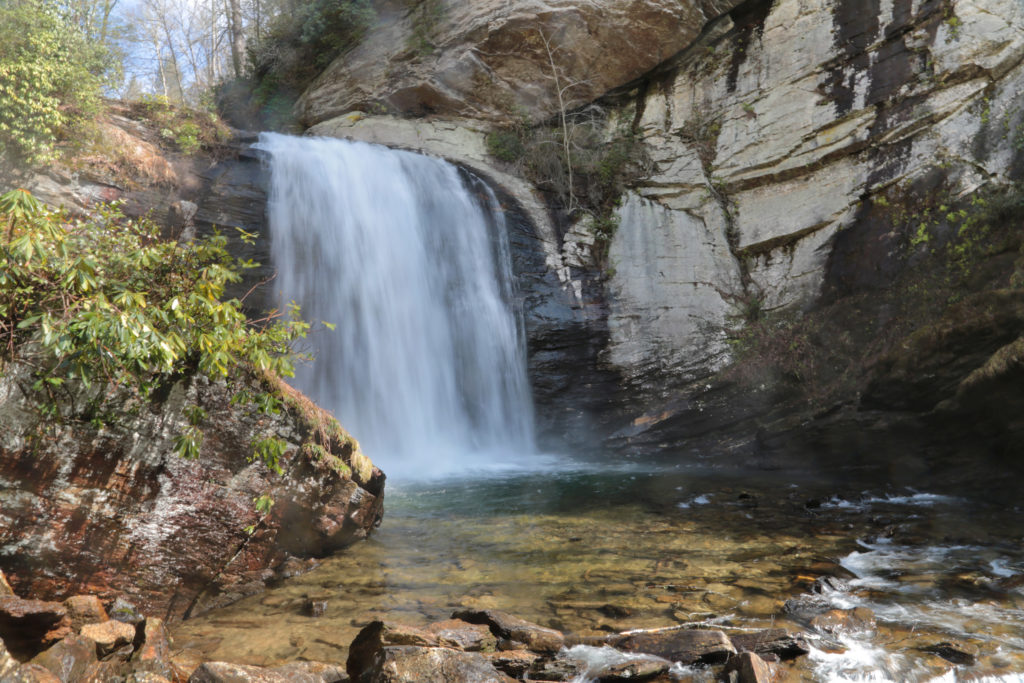

 Moore Cove Falls is one of the most popular waterfalls in Brevard. It’s also in my opinion, one of the most over-rated.
 The waterfall is 50 feet high and you can even walk behind it. To walk behind the waterfall, just walk around the deck.
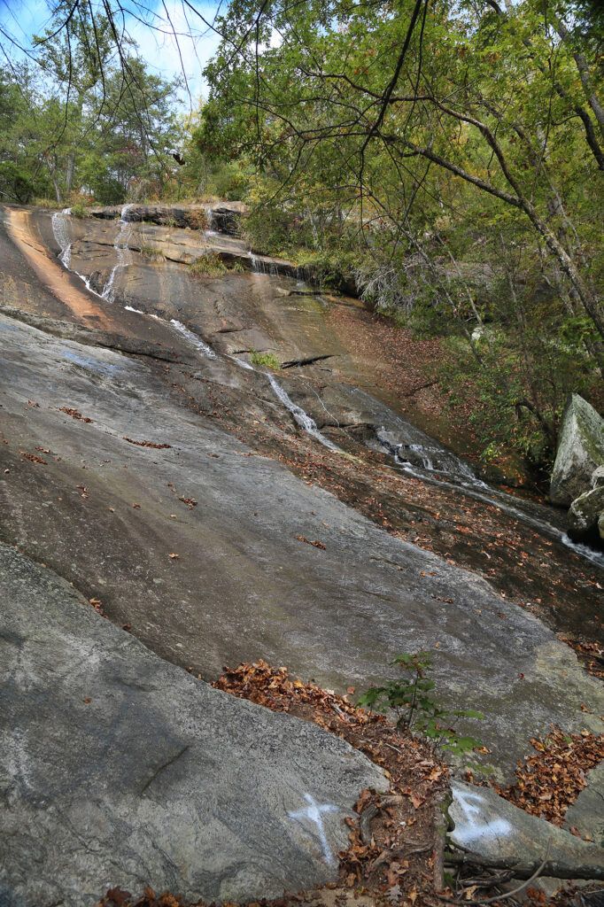
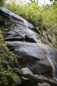
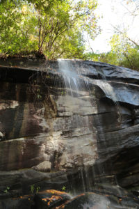
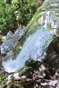
 Quarry Falls (also known as Upper Cullasaja Falls and Bust Your Butt Falls) is a 20-foot, multi-tiered cascade in the Cullasaja River Gorge.
 Silver Run Falls is a pretty 25 foot waterfall located in Nantahala National Forest located about 10 minutes from Cashiers, North Carolina. There’s a short well-worn trail through a scenic wooded area, about 0.25 feet in length to the base of the waterfall. Round trip would be about 0.5 miles.
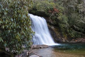 The parking area for Silver Run Falls is about four miles south from the intersection of Highway 64 and Highway 107 in Cashiers, North Carolina. Look for the sign for Silver Run Falls and parking area on the shoulder of the road off to your left. The parking area only holds about four or five cars. Do be careful when getting out of your car, especially with smaller children as the speed limit of the road next to the parking area is 55 mph and there is not much clearance between some spaces and the road.
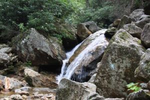
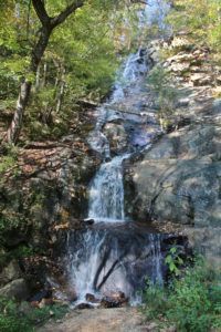 Silvervale Falls is a 80 foot roadside waterfall located in Caldwell County, near Blowing Rock, NC. There is a parking space right next to the waterfall, so there is no need to hike to this waterfall. It is quite pretty when not marked up by graffiti. Luckily the day I went, a lot of the graffiti had been cleaned off so it was much prettier than in previous years. Silvervale Falls is best visited in the morning or at dusk for the best photographs.
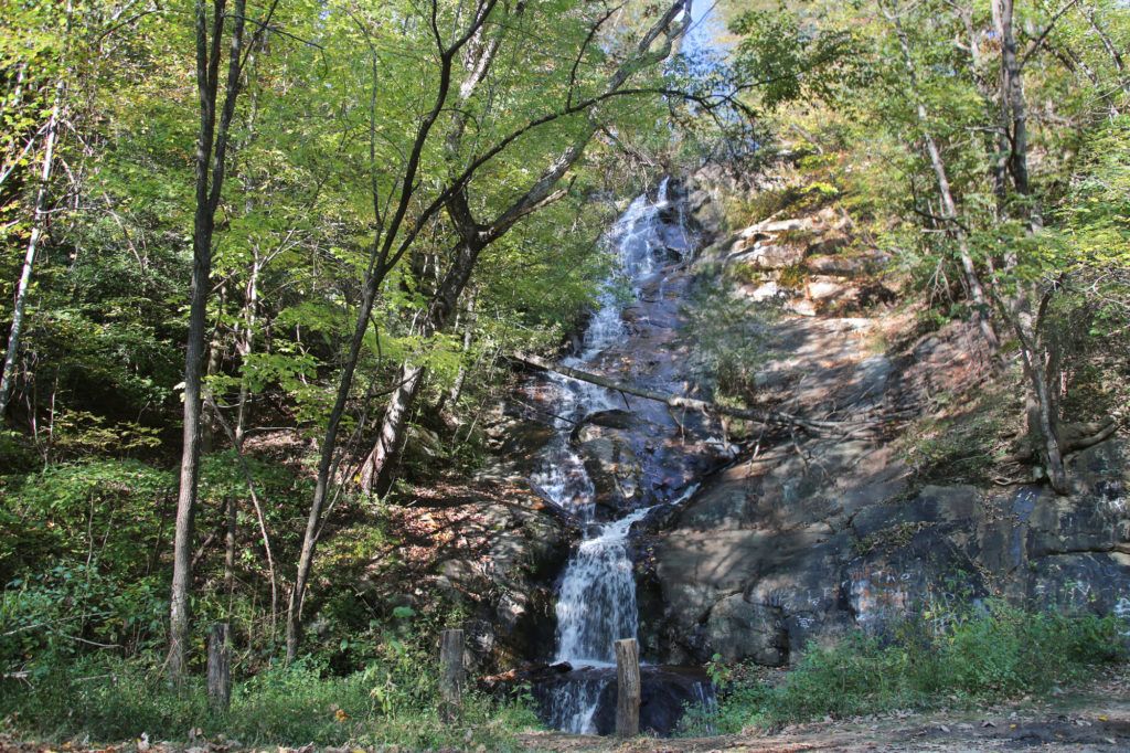
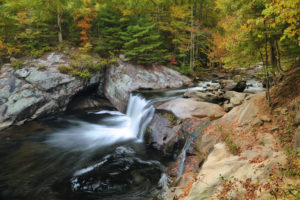
 Slick Rock Falls is a low-flow 30 foot waterfall located in Pisgah National Forest. The waterfall is named for the slick rocks at the top and bottom of the falls. The hike to Slick Rock Falls is short – only about 100 yards from the parking area. You do need to climb a few stairs to reach the waterfall. Like Moore Cove Falls (also found in Pisgah National Forest), you can also walk behind this waterfall. The rocks can be very slick so watch your step when walking close to the waterfall.
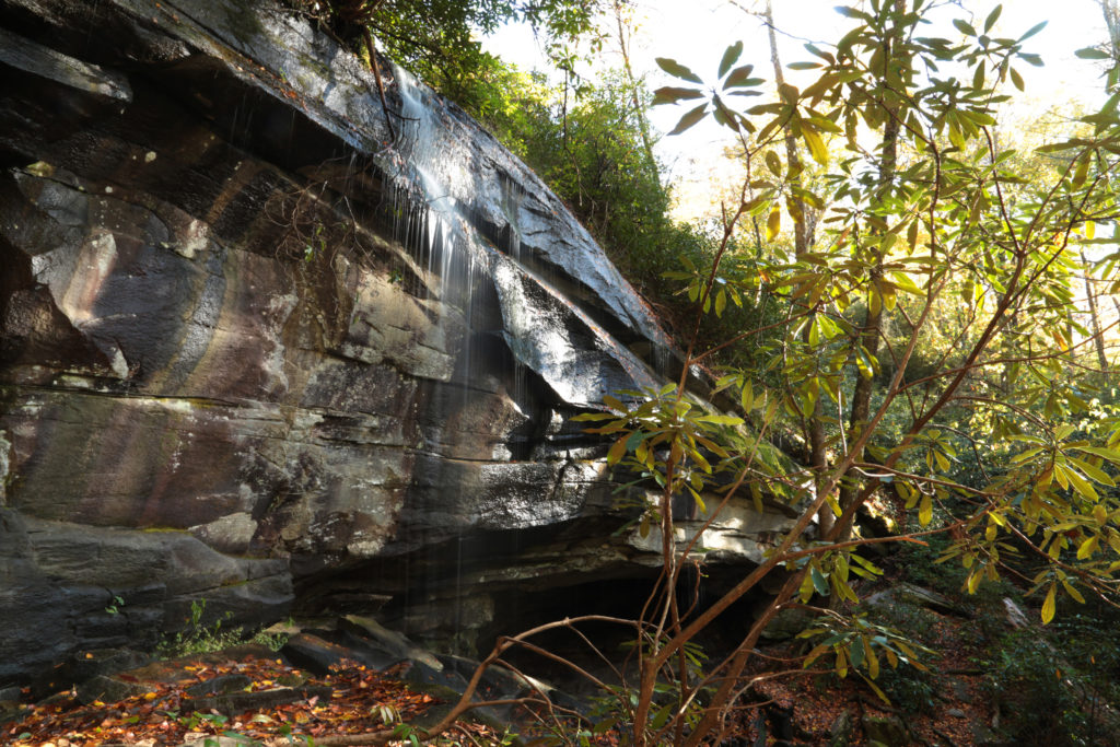
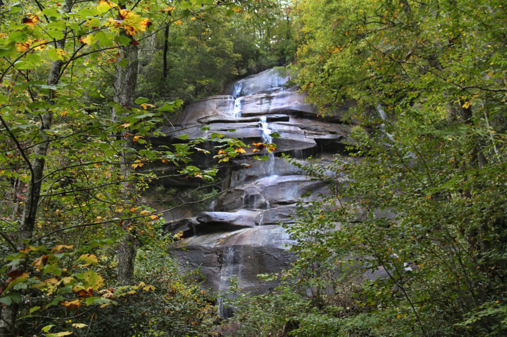
 Toxaway Falls, an impressive 150 foot waterfall, is located next to Highway 64 in North Carolina between Brevard and Cashiers.
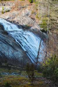 It’s a nice stop along the way on the curvy, scenic Highway 64 drive toward Cashiers and Highlands. A great place to get out and stretch your legs while enjoying a great view!
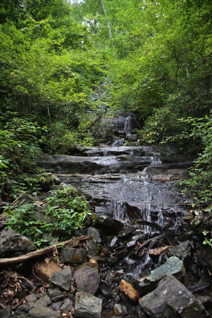
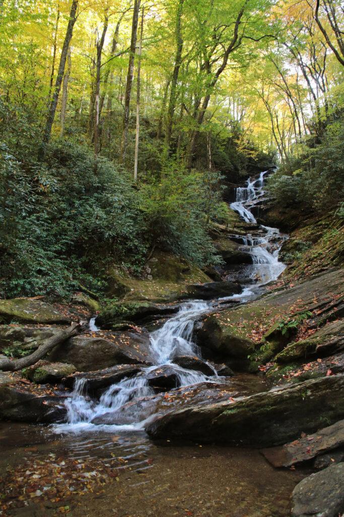
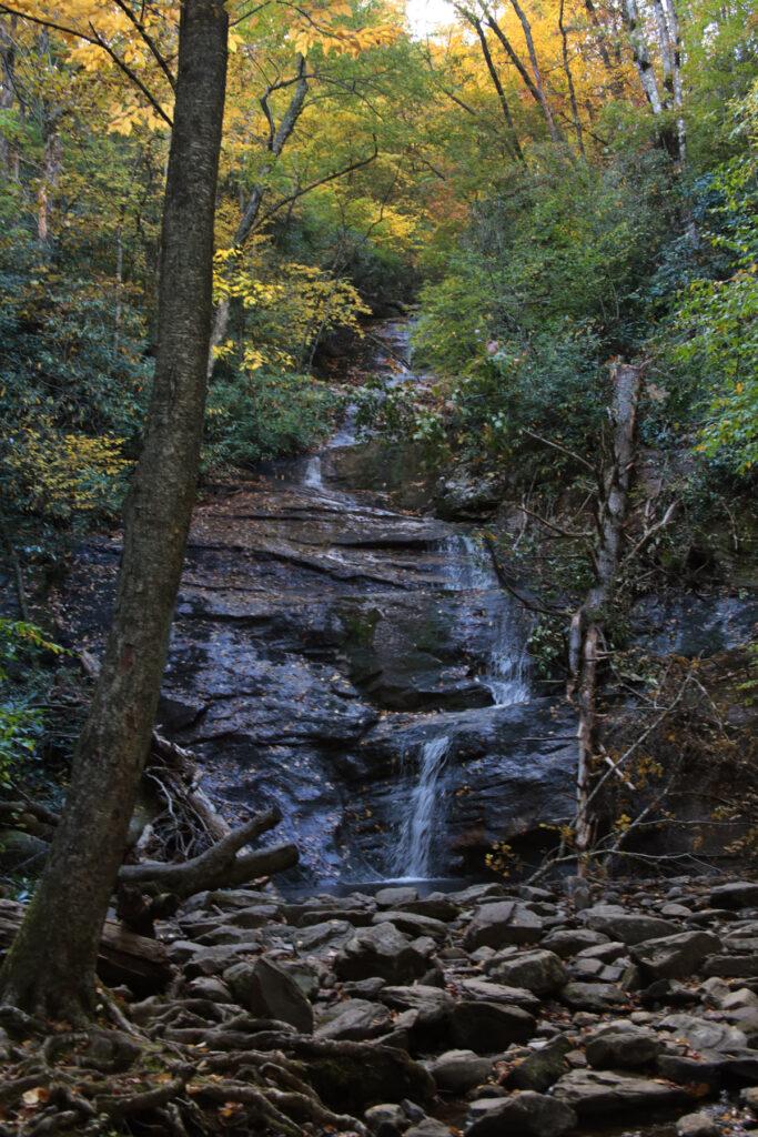
 The Waterfall at Rough Ridge Trail is located at milepost 302.8 on the Blue Ridge Parkway. This waterfall is best viewed after heavy rains. Most of the time there is hardly any water flow, as was the time when we last visited in March 2021.
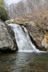
 Backbone Falls is an easy hike to a pretty waterfall located in Backbone Falls Recreation Area. There are many trails in this area that are fun to hike. Backbone Falls is located on the Backbone Falls Trail. It is designated with blue blazes.
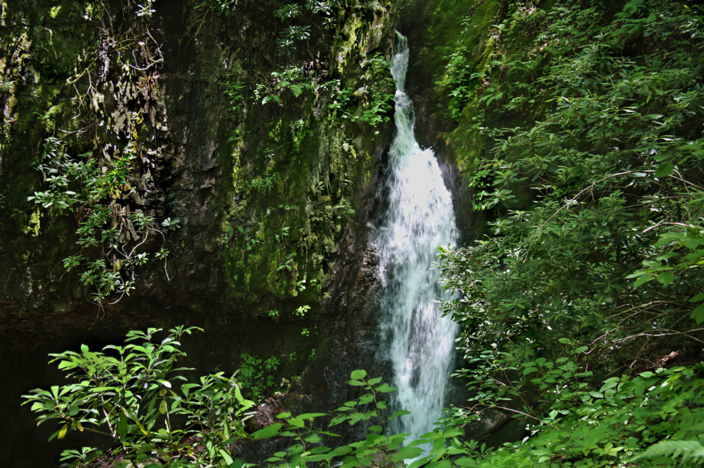
 If you’re looking for an easy waterfall without the crowds, then this one is for you! Bays Mountain Falls is a great roadside waterfall to check out. If you are visiting
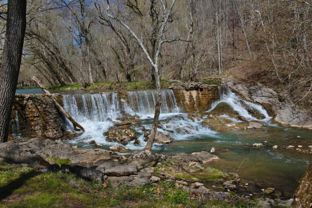
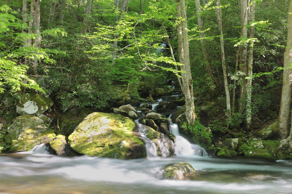
 Cataract Falls is an easy, family friendly trail that is perfect for a beginning hiker. It only takes about 15 minutes to hike to the base of the waterfall. This is a low flow waterfall, so don’t expect it to be big like its neighbors in the Great Smoky Mountain National Park. It is still pretty and scenic, especially after a good rain.
 Visitors frequently climb alongside Cataract Falls on the left side to the top tier of the two tiered Cataract Falls. I wouldn’t recommend this because it can become slippery and is a little steep coming back down. The National Park advises against doing this due to the risk of serious injury and death. In March of 2015 a visitor slipped on the rocks and fell 30 feet.
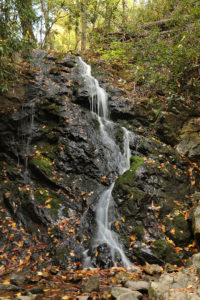
 Dolan Branch Falls is a pretty 20 foot waterfall located inside Bays Mountain Park. You’ll need to park in the parking lot closest to the main road entering into the park, close to the dam. The trail entrance for Dolan Branch Falls is located across the street from the dam.
 Most people have no idea that the waterfall is even there, so it is unlikely that you will encounter anyone down at the waterfall while you are there. It is quite peaceful and serene. I find it very relaxing and quiet – a great place to read or just unwind from a busy week.
 Dudley Falls is located in the Paint Creek Corridor in the Cherokee National Forest. While not the most impressive waterfall by height (it’s only 15 feet), the waterfall is really easy to find, being
 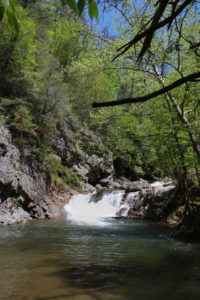 There are several picnic areas nearby that are quiet and have restrooms. Also during the summer months, there are several areas in the Paint Creek Corridor where the creek is stocked with trout during the summer months if you like to fish.
 Little Laurel Branch Falls is 50 foot waterfall that empties into Wilbur Lake. It is located near Elizabethton, TN in Carter County between Wilbur Dam and Watauga Dam. While not the most impressive waterfall, it is scenic and serene.
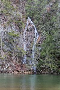 This waterfall is perfect for people of all ages, although it is not wheelchair accessible.
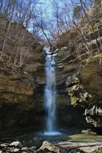 Lost Creek Falls is a 40 foot waterfall that flows directly into a sinkhole located inside Lost Creek State Natural Area. Lost Creek begins from large spring, drops over the falls, and then disappears underground.
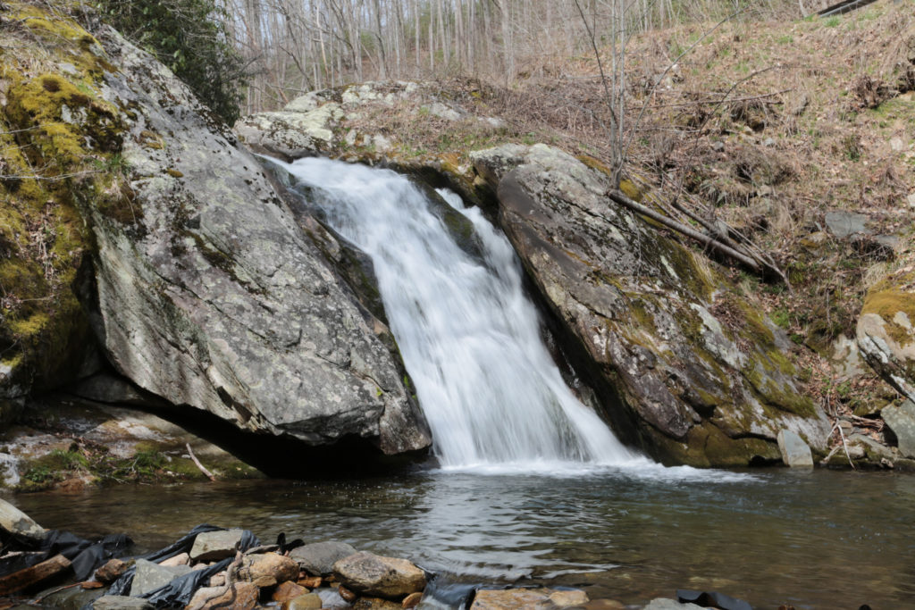
 Lower Spivey Falls is a pretty, 50 foot waterfall located on private property.
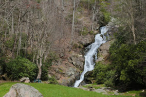 If you have time, you should check out
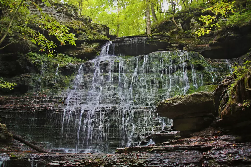
 Meigs Falls is a 30 foot waterfall that can be seen from a pull-off on Little River Road between Cades Cove and Sugarlands Visitor Center. The view is partially obstructed by trees in the summertime; otherwise the view is good, if not great.
 Millstone Creek Falls isn’t one of the easiest to find, but if you follow the directions, you shouldn’t have too hard a time finding this 30 foot waterfall. Millstone Creek Falls is located on private property on the western side of Buffalo Mountain in Washington County, but the owners give permission so long as visitors respect the property and don’t litter.
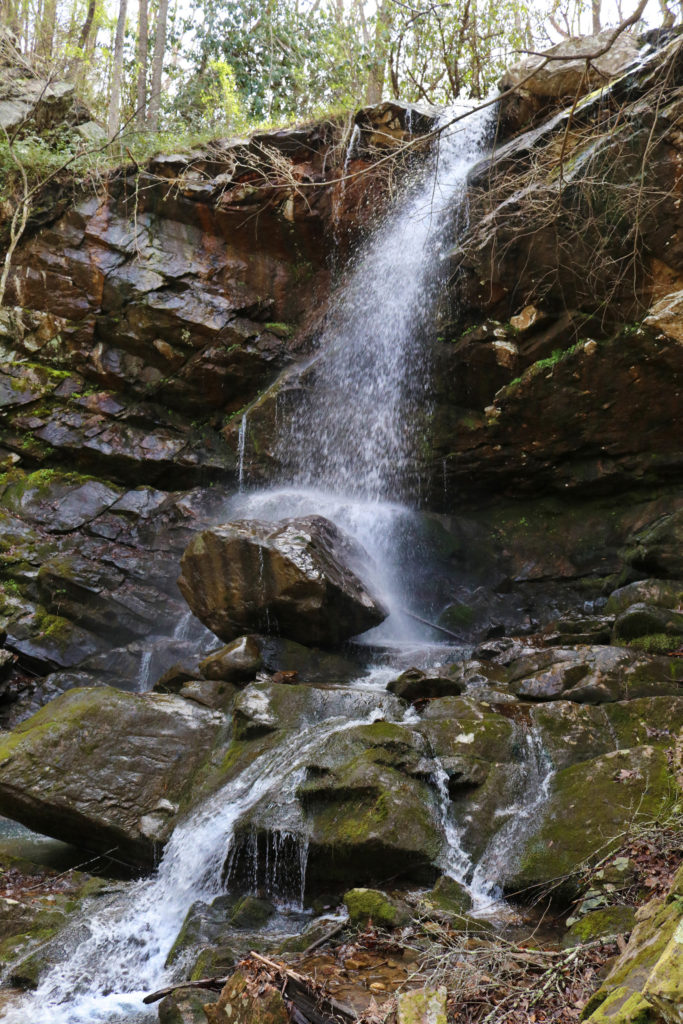
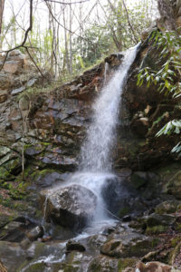
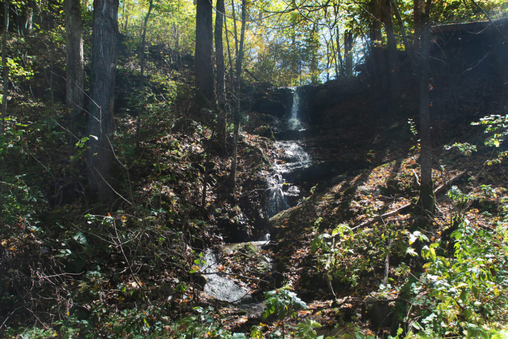
 Noisy Falls is a roadside waterfall near Cosby, Tennessee. There may not be much water flow on this waterfall, but it is still pretty to look at. The total height is between 20-30 feet.
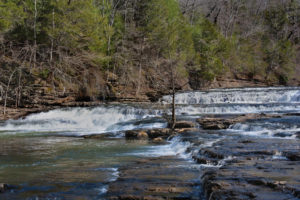
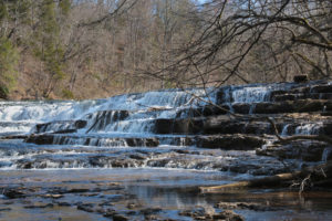
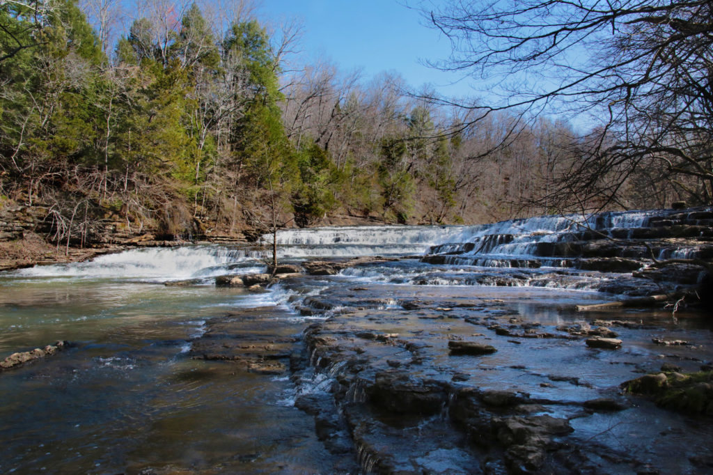
 Piney Creek Falls is located inside Fall Creek Falls State Park. Piney Creek Falls is a pretty waterfall that is easily viewable from an overlook located just a few minutes away from the parking area. A short trail about 0.2 miles will take you to the overlook for Piney Creek Falls. There is some obstruction of the waterfall from trees surrounding it, but it is still very scenic and peaceful.
 The Place of a Thousand Drips is a low flow waterfall that can be seen from your vehicle. It’s name is quite fitting. After a good rain it can be quite dramatic as the flow of water splits into many small bands of water cascading around the rocks and creates a “thousand drips”, however if there hasn’t been a good rain recently it is reduced to trickles of water and you’ll drive right past it without even knowing it was there (even when you are looking for it).
 The waterfall is located in Gatlinburg inside the Great Smoky Mountains National Park on its Roaring Fork Nature Motor Trail at the very end, near post #15. The road is a one-way, winding road that travels about 6 miles through spectacular scenery that you can see from the comfort of your car.
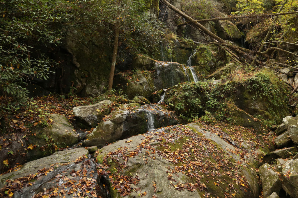
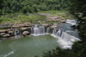
 Rockhouse Falls is located in Fall Creek Falls State Park. The really great thing about this waterfall is how close it is to many other waterfalls. Fall Creek Falls State Park has numerous waterfalls, including Fall Creek Falls, Cane Creek Falls, and Piney Creek Falls. Each of these waterfalls has a very easy way to view them with either short hikes or overlooks that are right by the parking areas.
 Rocky Fork Falls is located inside Lamar Alexander Rocky Fork State Park in Unicoi County. Like many of the waterfalls in the Cherokee National Forest, Rocky Fork Falls is reached by a narrow one way road with pull-offs. This state park is relatively new, opening in May 2015. The park was changed in January 2019 from Rocky Fork State Park to Lamar Alexander Rocky Fork State Park.
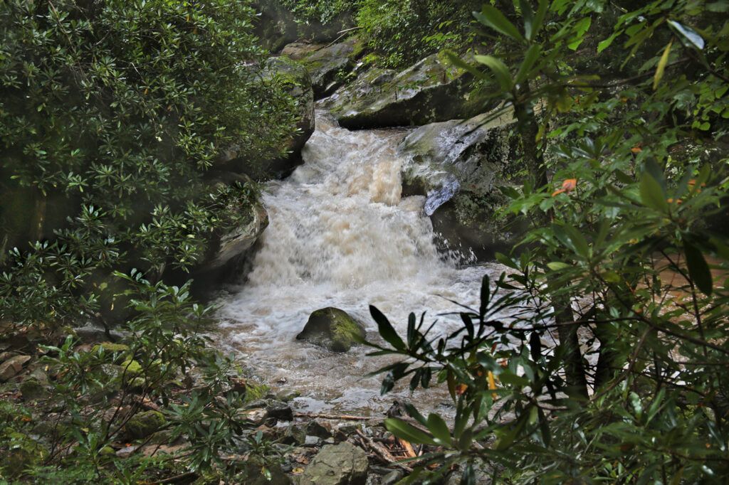
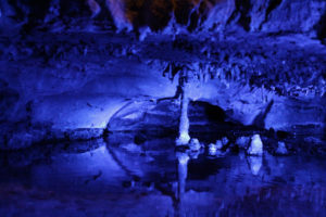
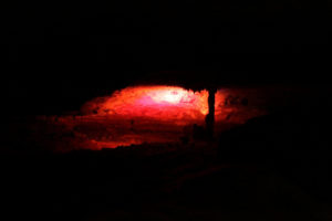
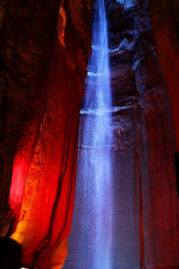 This waterfall and caverns, located over 1,120 feet underground, is one of my all time favorites. It’s so unique and beautiful. Although it does cost to get in, it is worth every penny.
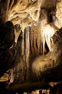
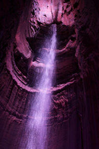 A word to the wise, bring a jacket with you, even in the summer if you plan to visit. The cavern is a cool sixty degrees year round. While in the area, I would also recommend the nearby Rock City, which has its own waterfall –
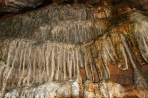
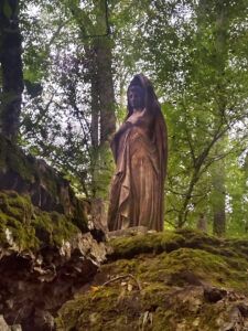 Just above the waterfall is the “Lady of the Falls” statue, which originally resided at the state capital grounds. During a renovation it was removed and scheduled for destruction. Permission was given to save one of the statues and placed at the top of Rutledge Falls where it stands just above the waterfall.
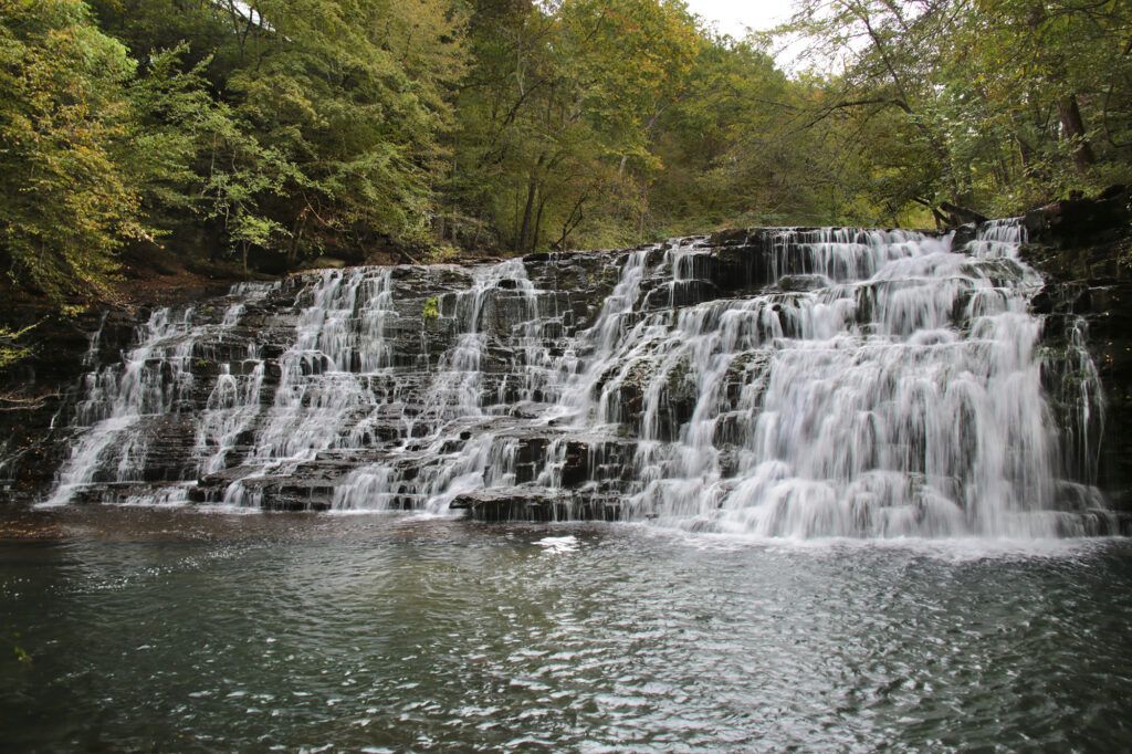
 As far as I can tell there is no “official” name for this waterfall. I’ve seen it called Steele Creek Park Falls or Rooster Front Falls, so I have listed both. This waterfall is located inside Rooster Front Park, which is actually part of Steele Creek Park.
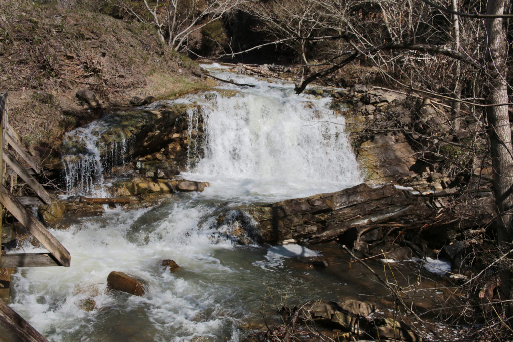
 The Sinks is a pretty waterfall that is very easy to access. It is a small waterfall that includes the entire flow of Little River. You can walk right up to a close-up overlook to the waterfall right from the parking lot.
 Upper Waterloo Falls is a 5 foot waterfall located about 15 minutes north of Cookeville. While 5 feet in height seems really small, this waterfall is probably one the widest I’ve ever seen. It isn’t the most impressive waterfall, but it is quite pretty and peaceful. There are also “angel wing” shells at the end of the path leading to the waterfall which my kids enjoyed finding.
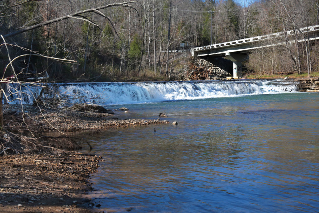
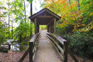
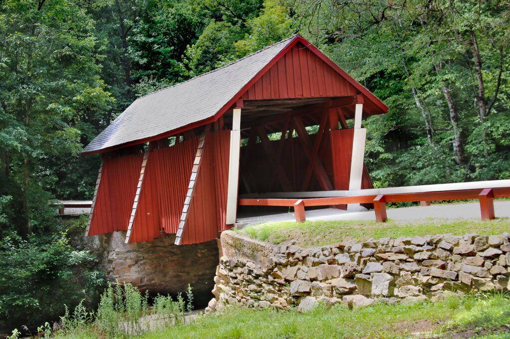
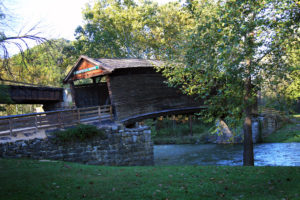 While in the area, be sure to check out Humpback Bridge in Covington, Virginia’s oldest covered bridge, built in 1857. It is one of a few remaining covered bridges in the United States features the unique “humpback style with it being built higher in the middle than on either of the ends.
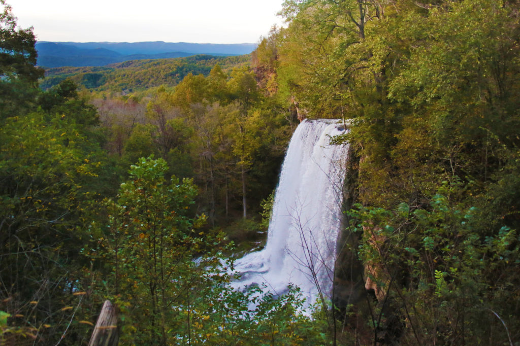
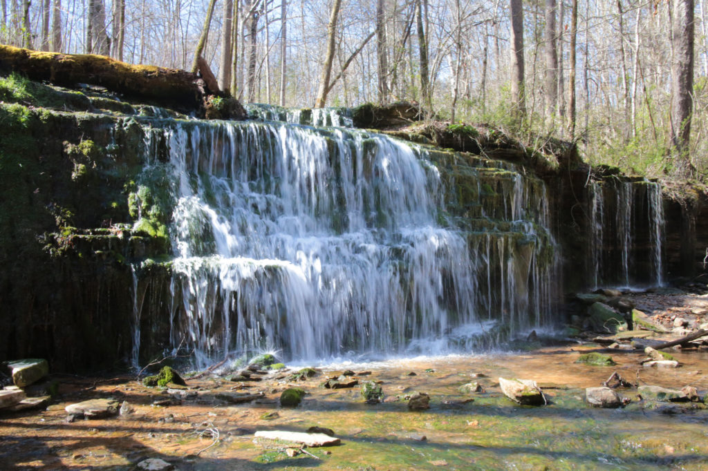
 Tank Hollow Falls, a beautiful 60 foot waterfall, is located inside the Cleveland Barrens Natural Area Preserve. This waterfall is perfect for the whole family. The parking area is only about 100 feet from the base of the waterfall. There is only about 5 parking spaces and one handicapped space. From the parking area follow the short gravel path to the base of the waterfall. Two picnic tables are available if you’d like to have a picnic lunch by the waterfall.
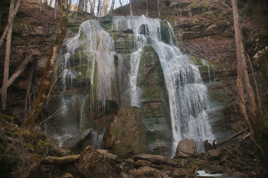
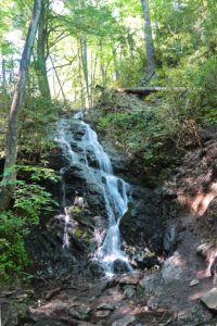
 Wigwam Falls is a pretty waterfall that is really easy to access. It is located on the Blue Ridge Parkway.